Approximate Location Map
Large Map »
Latitude: 51.2828 / 51°16'58"N
Longitude: 1.0728 / 1°4'21"E
OS Eastings: 614380
OS Northings: 158226
OS Grid: TR143582
Mapcode National: GBR TY2.G1S
Mapcode Global: VHLGM.J0ZX
Plus Code: 9F3373MF+44
Entry Name: 59, St Dunstan's Street
Listing Date: 3 May 1967
Grade: II
Source: Historic England
Source ID: 1241871
English Heritage Legacy ID: 441116
ID on this website: 101241871
Location: St Dunstan's, Canterbury, Kent, CT2
County: Kent
District: Canterbury
Electoral Ward/Division: Westgate
Parish: Non Civil Parish
Built-Up Area: Canterbury
Traditional County: Kent
Lieutenancy Area (Ceremonial County): Kent
Tagged with: Building
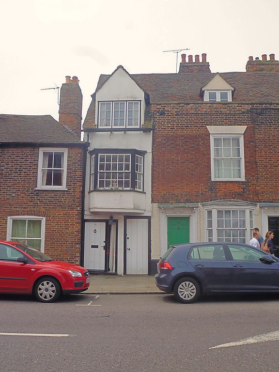
1.
944 ST DUNSTAN'S STREET
(South West Side)
No 59
TR 1458 SW 1/322 3.5.67.
II GV
2.
Originally part of the C16 range including Nos 56, 57 and 58. A timber-framed
building with a narrow frontage now faced with cement. 2 storeys and attic.
Tiled roof and eaves cornice. 1 window and 1 gabled dormer. Bay window on
1st floor.
Nos 51 to 66 (consec) form a group.
Listing NGR: TR1437258215
External links are from the relevant listing authority and, where applicable, Wikidata. Wikidata IDs may be related buildings as well as this specific building. If you want to add or update a link, you will need to do so by editing the Wikidata entry.


Other nearby listed buildings
