Approximate Location Map
Large Map »
Latitude: 51.2821 / 51°16'55"N
Longitude: 1.0742 / 1°4'27"E
OS Eastings: 614486
OS Northings: 158151
OS Grid: TR144581
Mapcode National: GBR TY2.GF0
Mapcode Global: VHLGM.K1RG
Plus Code: 9F3373JF+RM
Entry Name: 80, St Dunstan's Street
Listing Date: 7 September 1973
Grade: II
Source: Historic England
Source ID: 1241908
English Heritage Legacy ID: 441171
ID on this website: 101241908
Location: St Dunstan's, Canterbury, Kent, CT2
County: Kent
District: Canterbury
Electoral Ward/Division: Westgate
Parish: Non Civil Parish
Built-Up Area: Canterbury
Traditional County: Kent
Lieutenancy Area (Ceremonial County): Kent
Tagged with: Building
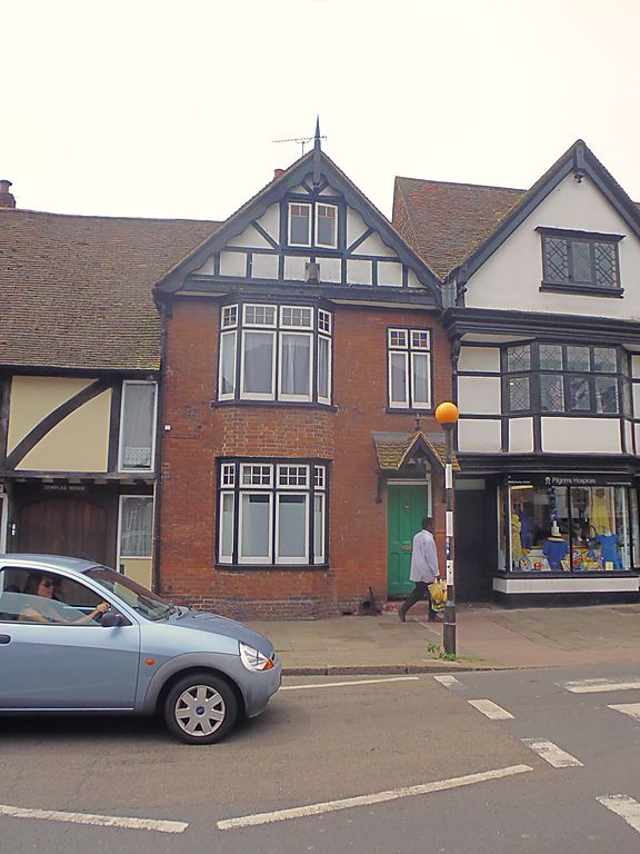
1.
944 ST DUNSTAN's STREET
(South West Side)
No 80
TR 1458 SW 1/660
II GV
2.
A timber-framed house restored in the late C19. 2 storeys red bricks Gable
with carved bargeboards and finial. 3 windows, 1 of them a bay. Doorcase
has hipped tiled weatherhood on brackets. Grade II for group value.
Nos 67 to 81 (consec) form a group.
Listing NGR: TR1448558149
External links are from the relevant listing authority and, where applicable, Wikidata. Wikidata IDs may be related buildings as well as this specific building. If you want to add or update a link, you will need to do so by editing the Wikidata entry.


Other nearby listed buildings
