Approximate Location Map
Large Map »
Latitude: 51.2776 / 51°16'39"N
Longitude: 1.0791 / 1°4'44"E
OS Eastings: 614848
OS Northings: 157670
OS Grid: TR148576
Mapcode National: GBR TY2.X82
Mapcode Global: VHLGM.N4BW
Plus Code: 9F3373HH+3J
Entry Name: 7, St Margaret's Street
Listing Date: 3 May 1967
Grade: II
Source: Historic England
Source ID: 1241919
English Heritage Legacy ID: 441195
ID on this website: 101241919
Location: Canterbury, Kent, CT1
County: Kent
District: Canterbury
Electoral Ward/Division: Westgate
Parish: Non Civil Parish
Built-Up Area: Canterbury
Traditional County: Kent
Lieutenancy Area (Ceremonial County): Kent
Tagged with: Building
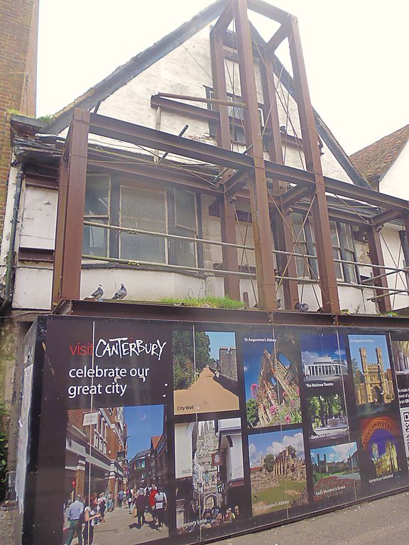
1.
944 ST MARGARET'S STREET
(South East Side)
No 7
TR 1457 NE 4/193 3.5.67.
II GV
2.
Early C17 and later. 2 storeys and attics timber-framed. Gable front is
painted brick. 1st floor is plastered. Old toed roof. 2 sashes in attic.
1st floor has 2 3-light canted bays only one of which has glazing bars intact.
Ground floor has later C19 shopfront with narrow panelled risers.
Nos 5 to 8 (consec) form a group.
Listing NGR: TR1486357673
External links are from the relevant listing authority and, where applicable, Wikidata. Wikidata IDs may be related buildings as well as this specific building. If you want to add or update a link, you will need to do so by editing the Wikidata entry.


Other nearby listed buildings
