Approximate Location Map
Large Map »
Latitude: 51.2774 / 51°16'38"N
Longitude: 1.0828 / 1°4'57"E
OS Eastings: 615104
OS Northings: 157658
OS Grid: TR151576
Mapcode National: GBR TY2.Y9F
Mapcode Global: VHLGM.Q581
Plus Code: 9F3373GM+X4
Entry Name: Remains of the Church of St George the Martyr Tower
Listing Date: 3 December 1949
Grade: II
Source: Historic England
Source ID: 1241984
English Heritage Legacy ID: 441186
ID on this website: 101241984
Location: Canterbury, Kent, CT1
County: Kent
District: Canterbury
Electoral Ward/Division: Westgate
Parish: Non Civil Parish
Built-Up Area: Canterbury
Traditional County: Kent
Lieutenancy Area (Ceremonial County): Kent
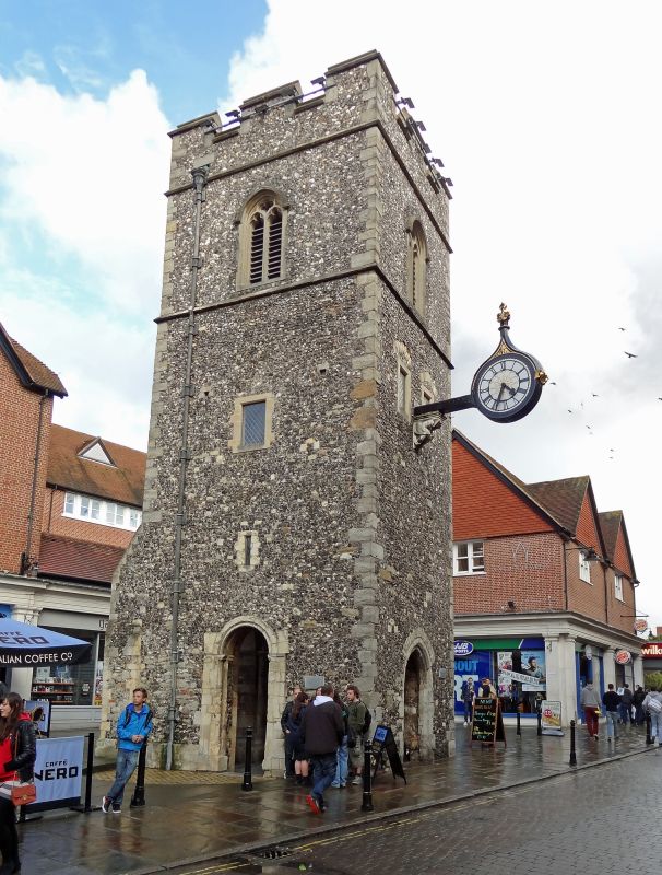
1.
944 ST GEORGE'S STREET
Tower (remains of the
Church of St George the Martyr)
TR 1557 NW 5/59 3.12.49.
II
2.
C15. Flint faced with stone quoins and dressings. Crenellated parapet. Windows
are restored lancets. Clock is supported by a stone bracket with crouching
figure. Plaque states that Christopher Marlowe was baptised here in 1564.
Listing NGR: TR1510457658
External links are from the relevant listing authority and, where applicable, Wikidata. Wikidata IDs may be related buildings as well as this specific building. If you want to add or update a link, you will need to do so by editing the Wikidata entry.


Other nearby listed buildings
