Approximate Location Map
Large Map »
Latitude: 51.2779 / 51°16'40"N
Longitude: 1.0933 / 1°5'35"E
OS Eastings: 615836
OS Northings: 157743
OS Grid: TR158577
Mapcode National: GBR TY3.TGF
Mapcode Global: VHLGM.W4VP
Plus Code: 9F3373HV+58
Entry Name: Wall Surrounding Churchyard
Listing Date: 7 September 1973
Grade: II
Source: Historic England
Source ID: 1242168
English Heritage Legacy ID: 441525
ID on this website: 101242168
Location: St Martin's, Canterbury, Kent, CT1
County: Kent
District: Canterbury
Electoral Ward/Division: Barton
Parish: Non Civil Parish
Built-Up Area: Canterbury
Traditional County: Kent
Lieutenancy Area (Ceremonial County): Kent
Tagged with: Wall
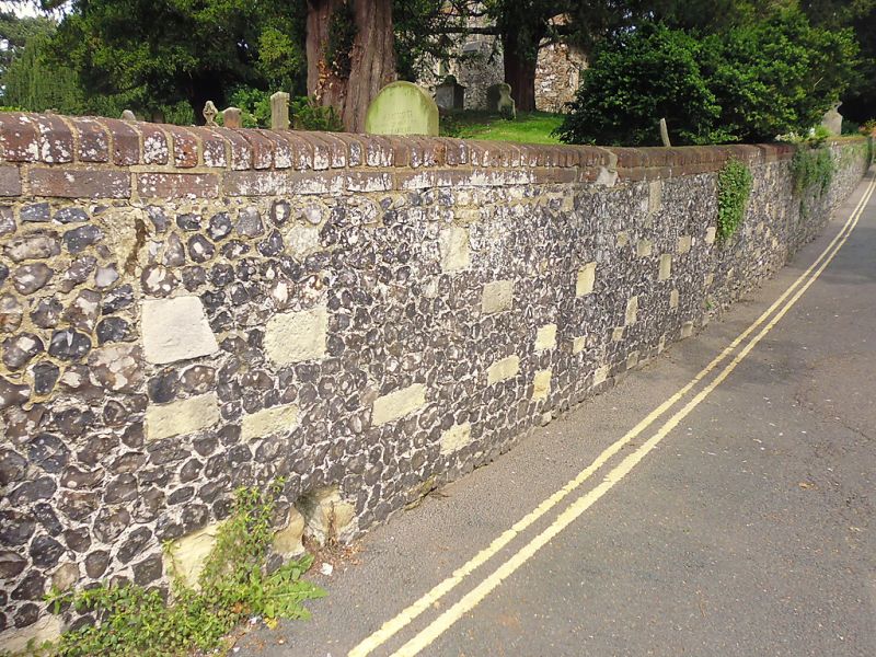
1.
944 ST MARTIN'S HILL
Wall surrounding churchyard.
TR 1557 NE 6/161A
II
2.
About 6 ft high, built of flint and reused mediaeval masonry with red brick
coping.
Listing NGR: TR1583057744
External links are from the relevant listing authority and, where applicable, Wikidata. Wikidata IDs may be related buildings as well as this specific building. If you want to add or update a link, you will need to do so by editing the Wikidata entry.


Other nearby listed buildings
