Approximate Location Map
Large Map »
Latitude: 51.2773 / 51°16'38"N
Longitude: 1.0755 / 1°4'31"E
OS Eastings: 614600
OS Northings: 157624
OS Grid: TR146576
Mapcode National: GBR TY2.W6X
Mapcode Global: VHLGM.L5G4
Plus Code: 9F3373GG+W6
Entry Name: 47, Stour Street
Listing Date: 3 May 1967
Grade: II
Source: Historic England
Source ID: 1242652
English Heritage Legacy ID: 443441
ID on this website: 101242652
Location: Canterbury, Kent, CT1
County: Kent
District: Canterbury
Electoral Ward/Division: Westgate
Parish: Non Civil Parish
Built-Up Area: Canterbury
Traditional County: Kent
Lieutenancy Area (Ceremonial County): Kent
Tagged with: Building
1.
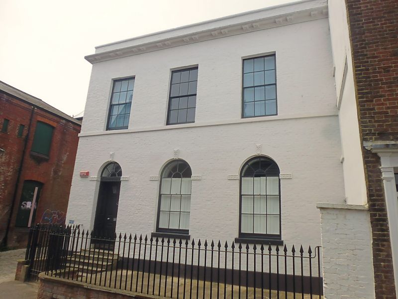
944 STOUR STREET
(North West Side)
No 47
TR 1457 NE 4/183 3.5.67.
II GV
2.
Early C19. 2 storeys painted brick. Parapet, modillion cornice and stringcourse.
Round-headed windows on the ground. floor. Glazing bars intact. Recessed
doorway with semi-circular fanlight and 8 panel moulded door.
No 42A and 44 to 47 (consec) form a group.
Listing NGR: TR1455057625
External links are from the relevant listing authority and, where applicable, Wikidata. Wikidata IDs may be related buildings as well as this specific building. If you want to add or update a link, you will need to do so by editing the Wikidata entry.


Other nearby listed buildings
