Approximate Location Map
Large Map »
Latitude: 51.2794 / 51°16'45"N
Longitude: 1.081 / 1°4'51"E
OS Eastings: 614969
OS Northings: 157874
OS Grid: TR149578
Mapcode National: GBR TY2.Q42
Mapcode Global: VHLGM.P3BJ
Plus Code: 9F3373HJ+Q9
Entry Name: 16 and 17, Sun Street
Listing Date: 3 May 1967
Grade: II
Source: Historic England
Source ID: 1242767
English Heritage Legacy ID: 443676
ID on this website: 101242767
Location: Canterbury, Kent, CT1
County: Kent
District: Canterbury
Electoral Ward/Division: Westgate
Parish: Non Civil Parish
Built-Up Area: Canterbury
Traditional County: Kent
Lieutenancy Area (Ceremonial County): Kent
Tagged with: Building
1.
944 SUN SET
(East Side)
Nos 16 and 17
TR 1457 NE 4/272 3.5.67.
II GV
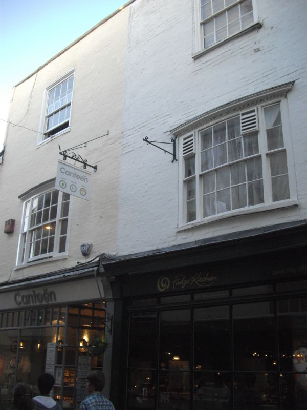
2.
Late C18 or early C19. 3 storeys painted brick. 2 sashes with glazing bars
intact set in moulded architraves. 1st floor has 2 C18 3 light bows. Wrought
iron shop sign bracket. Later C19 shop fronts.
Nos 14 to 24 (consec) form a group together with Nos 50 to 61 (consec) Palace
Street.
Listing NGR: TR1497657869
External links are from the relevant listing authority and, where applicable, Wikidata. Wikidata IDs may be related buildings as well as this specific building. If you want to add or update a link, you will need to do so by editing the Wikidata entry.


Other nearby listed buildings
