Approximate Location Map
Large Map »
Latitude: 51.2771 / 51°16'37"N
Longitude: 1.0787 / 1°4'43"E
OS Eastings: 614818
OS Northings: 157609
OS Grid: TR148576
Mapcode National: GBR TY2.X33
Mapcode Global: VHLGM.N539
Plus Code: 9F3373GH+RF
Entry Name: 28, Watling Street
Listing Date: 7 September 1973
Grade: II
Source: Historic England
Source ID: 1242791
English Heritage Legacy ID: 443722
ID on this website: 101242791
Location: Canterbury, Kent, CT1
County: Kent
District: Canterbury
Electoral Ward/Division: Westgate
Parish: Non Civil Parish
Built-Up Area: Canterbury
Traditional County: Kent
Lieutenancy Area (Ceremonial County): Kent
Tagged with: Building
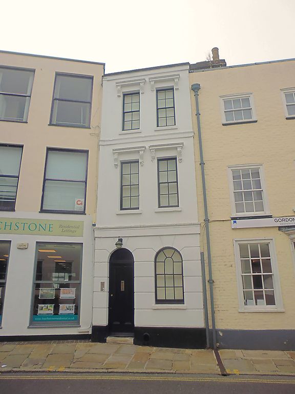
1.
944 WATLING STREET
(South West Side)
TR 1457 NE 4/720 No 28
II
2.
Outwardly early C19. 3 storeys and basement staccoed. Stone parapet. 2 sashes
with glazing bars intact. Stringcourse. Cornice and console brackets above
each window. Rusticated ground floor with 1 round-headed window. Plain round-headed
doorcase.
Listing NGR: TR1481657607
External links are from the relevant listing authority and, where applicable, Wikidata. Wikidata IDs may be related buildings as well as this specific building. If you want to add or update a link, you will need to do so by editing the Wikidata entry.


Other nearby listed buildings
