Approximate Location Map
Large Map »
Latitude: 51.2812 / 51°16'52"N
Longitude: 1.0748 / 1°4'29"E
OS Eastings: 614531
OS Northings: 158056
OS Grid: TR145580
Mapcode National: GBR TY2.NJM
Mapcode Global: VHLGM.L224
Plus Code: 9F3373JF+FW
Entry Name: 1, Westgate Grove
Listing Date: 3 May 1967
Grade: II
Source: Historic England
Source ID: 1242793
English Heritage Legacy ID: 443726
ID on this website: 101242793
Location: Canterbury, Kent, CT2
County: Kent
District: Canterbury
Electoral Ward/Division: Westgate
Parish: Non Civil Parish
Built-Up Area: Canterbury
Traditional County: Kent
Lieutenancy Area (Ceremonial County): Kent
Tagged with: Building
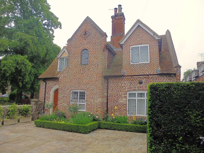
1.
944 WESTGATE GROVE
(South Side)
No 1
TR 1458 SE 2/340 3.5.67.
II
2.
Originally a C17 cottage. 2 storeys red brick. Tiled roof. Gabled projection
in the centre and gabled dormer on each side of this. Casement windows.
Rear elevation is part tile-hung.
Listing NGR: TR1453058054
External links are from the relevant listing authority and, where applicable, Wikidata. Wikidata IDs may be related buildings as well as this specific building. If you want to add or update a link, you will need to do so by editing the Wikidata entry.


Other nearby listed buildings
