Approximate Location Map
Large Map »
Latitude: 51.2773 / 51°16'38"N
Longitude: 1.0788 / 1°4'43"E
OS Eastings: 614827
OS Northings: 157631
OS Grid: TR148576
Mapcode National: GBR TY2.X4B
Mapcode Global: VHLGM.N554
Plus Code: 9F3373GH+WG
Entry Name: 23, Watling Street
Listing Date: 3 May 1967
Grade: II
Source: Historic England
Source ID: 1242837
English Heritage Legacy ID: 443716
ID on this website: 101242837
Location: Canterbury, Kent, CT1
County: Kent
District: Canterbury
Electoral Ward/Division: Westgate
Parish: Non Civil Parish
Built-Up Area: Canterbury
Traditional County: Kent
Lieutenancy Area (Ceremonial County): Kent
Tagged with: Building
1.
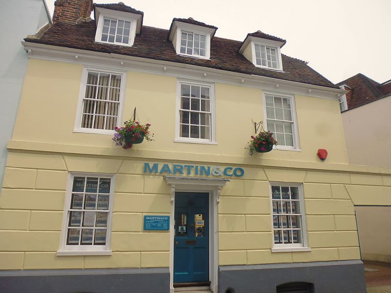
944 WATLING STREET
(North East Side)
No 23
TR 1457 NE 4/220 3.5.67.
II GV
2.
Early C18. 2 storeys basement and attic stuccoed, the ground floor rusticated.
Slate mansard roof having 3 hipped dormers.
Forms a group with Nos 1 and 2 St Margaret`s Street.
Listing NGR: TR1482957630
External links are from the relevant listing authority and, where applicable, Wikidata. Wikidata IDs may be related buildings as well as this specific building. If you want to add or update a link, you will need to do so by editing the Wikidata entry.


Other nearby listed buildings
