Approximate Location Map
Large Map »
Latitude: 51.2815 / 51°16'53"N
Longitude: 1.0749 / 1°4'29"E
OS Eastings: 614539
OS Northings: 158081
OS Grid: TR145580
Mapcode National: GBR TY2.NKM
Mapcode Global: VHLGM.L14Z
Plus Code: 9F3373JF+HX
Entry Name: 12, Westgate Grove
Listing Date: 3 May 1967
Grade: II
Source: Historic England
Source ID: 1242875
English Heritage Legacy ID: 443885
ID on this website: 101242875
Location: Canterbury, Kent, CT2
County: Kent
District: Canterbury
Electoral Ward/Division: Westgate
Parish: Non Civil Parish
Built-Up Area: Canterbury
Traditional County: Kent
Lieutenancy Area (Ceremonial County): Kent
Tagged with: Building
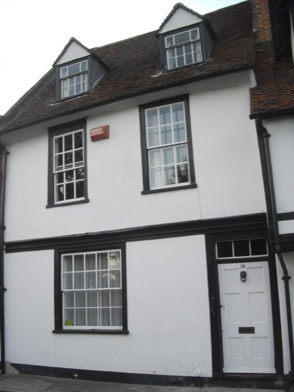
1.
944 WESTGATE GROVE
(North Side)
No 12
TR 1458 SE 2/124A 3.5.67.
II GV
2.
A timber-framed building refaced in C18 but the bressumer is still visible.
2 storeys stuccoed. Old tiled roof having 2 hipped dormers with sashes. Coved
eaves cornice. 2 sashes with glazing bars intact in moulded wooden architraves.
Doorcase has a weatherhood and rectangular fanlight. 4 panelled door.
Nos 2 to 14 (even) form a group.
Listing NGR: TR1453558084
External links are from the relevant listing authority and, where applicable, Wikidata. Wikidata IDs may be related buildings as well as this specific building. If you want to add or update a link, you will need to do so by editing the Wikidata entry.


Other nearby listed buildings
