Approximate Location Map
Large Map »
Latitude: 51.2843 / 51°17'3"N
Longitude: 1.0704 / 1°4'13"E
OS Eastings: 614208
OS Northings: 158380
OS Grid: TR142583
Mapcode National: GBR TY2.FFB
Mapcode Global: VHLGF.HZQC
Plus Code: 9F3373MC+P5
Entry Name: 7-11, Whitstable Road
Listing Date: 7 September 1973
Grade: II
Source: Historic England
Source ID: 1242877
English Heritage Legacy ID: 443889
ID on this website: 101242877
Location: St Dunstan's, Canterbury, Kent, CT2
County: Kent
District: Canterbury
Electoral Ward/Division: St Stephen's
Parish: Non Civil Parish
Built-Up Area: Canterbury
Traditional County: Kent
Lieutenancy Area (Ceremonial County): Kent
Tagged with: Building
1.
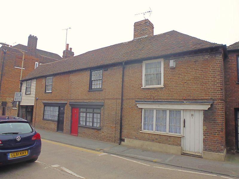
944 WHITSTABLE ROAD
(West Side)
Nos 7 to 11 (odd)
TR 1458 SW 1/722
II
2.
Late C18. 2 storeys red brick. Tiled roof, hipped on one side. Brick modillion
cornice. 3 sashes with glazing bars intact. Later shop-fronts. No 7 has
a left side extension over a carriage entrance which is weatherboarded. 1
sash only.
Listing NGR: TR1420358382
External links are from the relevant listing authority and, where applicable, Wikidata. Wikidata IDs may be related buildings as well as this specific building. If you want to add or update a link, you will need to do so by editing the Wikidata entry.


Other nearby listed buildings
