Approximate Location Map
Large Map »
Latitude: 51.2743 / 51°16'27"N
Longitude: 1.0734 / 1°4'24"E
OS Eastings: 614467
OS Northings: 157278
OS Grid: TR144572
Mapcode National: GBR TY8.26V
Mapcode Global: VHLGM.K7BH
Plus Code: 9F3373FF+P9
Entry Name: 13, Wincheap
Listing Date: 7 September 1973
Grade: II
Source: Historic England
Source ID: 1242881
English Heritage Legacy ID: 443899
ID on this website: 101242881
Location: Canterbury, Kent, CT1
County: Kent
District: Canterbury
Electoral Ward/Division: Wincheap
Parish: Non Civil Parish
Built-Up Area: Canterbury
Traditional County: Kent
Lieutenancy Area (Ceremonial County): Kent
Tagged with: Building
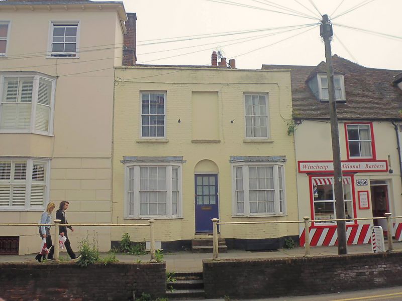
1.
944 WINCHEAP
(South East Side)
No 13
TR 1457 SW 7/725
II GV
2.
Early C19. 2 storeys red brick. Hipped old tiled roof. 2 C19 sashes with
1 blank. Ground floor has 2 canted bays and a simple semi-circular doorcase
with 3 steps.
Nos 11 to 17 (odd) form a group.
Listing NGR: TR1446757278
External links are from the relevant listing authority and, where applicable, Wikidata. Wikidata IDs may be related buildings as well as this specific building. If you want to add or update a link, you will need to do so by editing the Wikidata entry.


Other nearby listed buildings
