Approximate Location Map
Large Map »
Latitude: 51.2815 / 51°16'53"N
Longitude: 1.075 / 1°4'30"E
OS Eastings: 614543
OS Northings: 158083
OS Grid: TR145580
Mapcode National: GBR TY2.NLQ
Mapcode Global: VHLGM.L15Y
Plus Code: 9F3373JG+H2
Entry Name: Stour Cottage
Listing Date: 3 December 1949
Last Amended: 7 September 1973
Grade: II
Source: Historic England
Source ID: 1242909
English Heritage Legacy ID: 443884
ID on this website: 101242909
Location: Canterbury, Kent, CT2
County: Kent
District: Canterbury
Electoral Ward/Division: Westgate
Parish: Non Civil Parish
Built-Up Area: Canterbury
Traditional County: Kent
Lieutenancy Area (Ceremonial County): Kent
Tagged with: Cottage
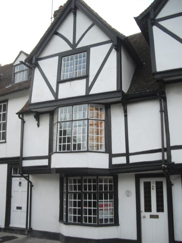
1.
944 WESTGATE GROVE
(North Side)
No 10
(Stour cottage)
(Formerly listed as
TR 1458 SE 2/124 No 4
3.12.49.
II GV
2.
Originally part of the old Cock Inn. A C16 timber-framed building. 3 storeys
and gable plastered. Renewed tiled roof. Gable front with bargeboards.
1 casement. Overhang, 1st floor has a 3 light mullioned and transomed bay
and a modern doorcase.
Nos 2 to 14 (even) form a group.
Listing NGR: TR1454058088
External links are from the relevant listing authority and, where applicable, Wikidata. Wikidata IDs may be related buildings as well as this specific building. If you want to add or update a link, you will need to do so by editing the Wikidata entry.


Other nearby listed buildings
