Approximate Location Map
Large Map »
Latitude: 51.4408 / 51°26'26"N
Longitude: 0.7678 / 0°46'3"E
OS Eastings: 592452
OS Northings: 174945
OS Grid: TQ924749
Mapcode National: GBR RS2.NXP
Mapcode Global: VHKJ7.817T
Plus Code: 9F32CQR9+84
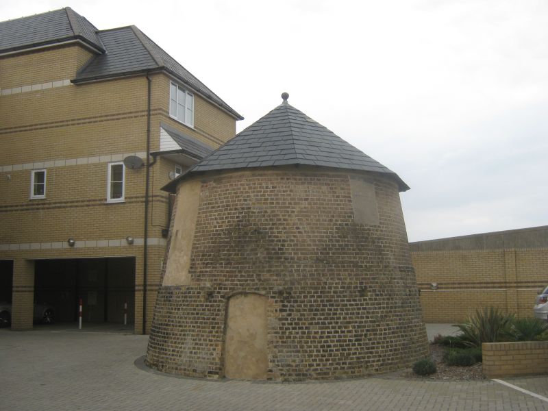
Entry Name: Remains of Windmill in Grounds of Seaview Hotel
Listing Date: 30 June 1978
Grade: II
Source: Historic England
Source ID: 1242981
English Heritage Legacy ID: 443871
ID on this website: 101242981
Location: Sheerness, Swale, Kent, ME12
County: Kent
District: Swale
Electoral Ward/Division: Sheerness
Parish: Sheerness
Built-Up Area: Sheerness
Traditional County: Kent
Lieutenancy Area (Ceremonial County): Kent
Tagged with: Windmill
THE BROADWAY
1.
5282
(North Side)
Mile Town, Sheerness
Remains of windmill in
grounds of Seaview Hotel
TQ 9274 NW 9/4
II
2.
C18. Stock brick partly stuccoed base of cylindrical shape tapering inwards
towards the top. Slate roof.
Listing NGR: TQ9245274945
External links are from the relevant listing authority and, where applicable, Wikidata. Wikidata IDs may be related buildings as well as this specific building. If you want to add or update a link, you will need to do so by editing the Wikidata entry.


Other nearby listed buildings
