Approximate Location Map
Large Map »
Latitude: 51.274 / 51°16'26"N
Longitude: 1.0721 / 1°4'19"E
OS Eastings: 614373
OS Northings: 157244
OS Grid: TR143572
Mapcode National: GBR TY8.1VP
Mapcode Global: VHLGM.J7MP
Plus Code: 9F3373FC+HR
Entry Name: Duke's Head Public House
Listing Date: 7 September 1973
Grade: II
Source: Historic England
Source ID: 1242991
English Heritage Legacy ID: 444135
ID on this website: 101242991
Location: Canterbury, Kent, CT1
County: Kent
District: Canterbury
Electoral Ward/Division: Wincheap
Parish: Non Civil Parish
Built-Up Area: Canterbury
Traditional County: Kent
Lieutenancy Area (Ceremonial County): Kent
Tagged with: Pub
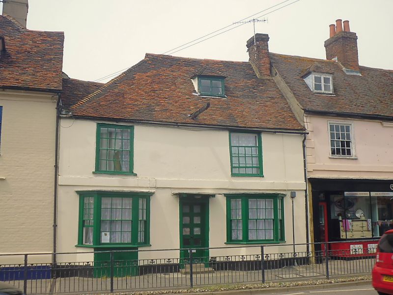
1.
944 WINCHEAP
(North Nest Side)
No 62
(Duke's Head Public House)
TR 1457 SW 7/359
II GV
2.
C18. 2 storeys stuccoed. Hipped tiled roof with 1 hipped dormer. 2 sashes
with glazing bars intact on 1st floor, and stringcourse. Ground floor has
2 C19 canted bays.
Nos 42 to 64 (even) form a group.
Listing NGR: TR1437357244
External links are from the relevant listing authority and, where applicable, Wikidata. Wikidata IDs may be related buildings as well as this specific building. If you want to add or update a link, you will need to do so by editing the Wikidata entry.


Other nearby listed buildings
