Approximate Location Map
Large Map »
Latitude: 51.4413 / 51°26'28"N
Longitude: 0.7487 / 0°44'55"E
OS Eastings: 591124
OS Northings: 174950
OS Grid: TQ911749
Mapcode National: GBR RS1.Q39
Mapcode Global: VHKJ6.X1NF
Plus Code: 9F32CPRX+GF
Entry Name: Outbuilding to Rear of the Royal Fountain Hotel
Listing Date: 30 June 1978
Grade: II
Source: Historic England
Source ID: 1243077
English Heritage Legacy ID: 446551
ID on this website: 101243077
Location: Blue Town, Swale, Kent, ME12
County: Kent
District: Swale
Electoral Ward/Division: Sheerness
Parish: Sheerness
Built-Up Area: Sheerness
Traditional County: Kent
Lieutenancy Area (Ceremonial County): Kent
Tagged with: Appendage
WEST STREET
1.
5282
(East Side)
Blue Town, Sheerness
Outbuilding to rear
of the Royal Fountain
Hotel
TQ 9174 NW 3/124
II GV
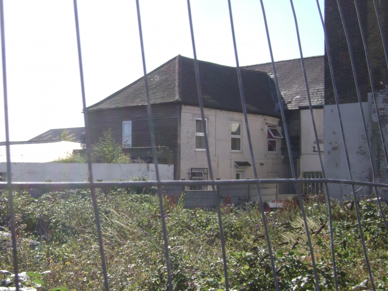
2.
The facade to West Lane is C19 but to the rear there is an C18 tarred weatherboarded
building of 2 storeys with 4 sashes with glazing bars intact. T-shaped rear
part having hipped old tiled roof. The front part has a slate roof.
Listing NGR: TQ9112474950
External links are from the relevant listing authority and, where applicable, Wikidata. Wikidata IDs may be related buildings as well as this specific building. If you want to add or update a link, you will need to do so by editing the Wikidata entry.


Other nearby listed buildings
