Approximate Location Map
Large Map »
Latitude: 53.2519 / 53°15'6"N
Longitude: -1.4213 / 1°25'16"W
OS Eastings: 438709
OS Northings: 372921
OS Grid: SK387729
Mapcode National: GBR LZJV.30
Mapcode Global: WHDF9.4JGC
Plus Code: 9C5W7H2H+QF
Entry Name: Tapton Lock
Listing Date: 28 December 1979
Grade: II
Source: Historic England
Source ID: 1244623
English Heritage Legacy ID: 449792
ID on this website: 101244623
Location: Tapton, Chesterfield, Derbyshire, S41
County: Derbyshire
District: Chesterfield
Electoral Ward/Division: Moor
Parish: Non Civil Parish
Traditional County: Derbyshire
Lieutenancy Area (Ceremonial County): Derbyshire
Church of England Parish: Chesterfield Holy Trinity
Church of England Diocese: Derby
Tagged with: Lock Architectural structure
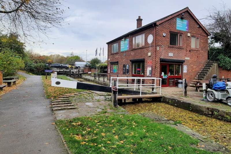
1. LOCKFORD LANE
5169
Tapton Lock
SE 37 SE 13/288
II
2.
Circa 1777. (Chesterfield Canal by James Brindley but completed by his brother-in-law Henshall). Narrow lock constructed of stone with brick band and stone coping. Stone coped brickwork at entrance.
Listing NGR: SK3870972921
External links are from the relevant listing authority and, where applicable, Wikidata. Wikidata IDs may be related buildings as well as this specific building. If you want to add or update a link, you will need to do so by editing the Wikidata entry.


Other nearby listed buildings
