Approximate Location Map
Large Map »
Latitude: 53.3903 / 53°23'24"N
Longitude: -1.4752 / 1°28'30"W
OS Eastings: 435000
OS Northings: 388287
OS Grid: SK350882
Mapcode National: GBR 9GG.7H
Mapcode Global: WHDDP.91SS
Plus Code: 9C5W9GRF+4W
Entry Name: Ball Street Bridge Kelham Weir
Listing Date: 18 November 1985
Last Amended: 12 December 1995
Grade: II
Source: Historic England
Source ID: 1246510
English Heritage Legacy ID: 455318
ID on this website: 101246510
Location: Kelham Island, Sheffield, South Yorkshire, S3
County: Sheffield
Electoral Ward/Division: City
Parish: Non Civil Parish
Built-Up Area: Sheffield
Traditional County: Yorkshire
Lieutenancy Area (Ceremonial County): South Yorkshire
Church of England Parish: Pitsmoor Christ Church
Church of England Diocese: Sheffield
Tagged with: Bridge
SHEFFIELD
SK3488SE BALL STREET
784-1/14/48 (East side (off))
18/11/85 Kelham Weir
(Formerly Listed as:
KELHAM WEIR
Ball Street Bridge, Beckett's Gable
Wall, Kelham Weir)
GV II
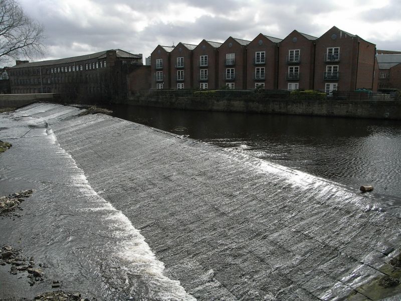
Weir on River Don. c1800. Coursed squared stone with ashlar
sill. Slightly curved. Approx 100m long.
Listing NGR: SK3500088287
External links are from the relevant listing authority and, where applicable, Wikidata. Wikidata IDs may be related buildings as well as this specific building. If you want to add or update a link, you will need to do so by editing the Wikidata entry.


Other nearby listed buildings
