Approximate Location Map
Large Map »
Latitude: 50.7995 / 50°47'58"N
Longitude: -1.1255 / 1°7'31"W
OS Eastings: 461723
OS Northings: 100352
OS Grid: SU617003
Mapcode National: GBR VKK.DZ
Mapcode Global: FRA 86JZ.HB5
Plus Code: 9C2WQVXF+QQ
Entry Name: Southern Boundary Wall to Royal Clarence Yard
Listing Date: 1 March 2001
Grade: II
Source: Historic England
Source ID: 1246654
English Heritage Legacy ID: 486981
ID on this website: 101246654
Location: Gosport, Hampshire, PO12
County: Hampshire
District: Gosport
Electoral Ward/Division: Christchurch
Parish: Non Civil Parish
Built-Up Area: Gosport
Traditional County: Hampshire
Lieutenancy Area (Ceremonial County): Hampshire
Church of England Parish: Gosport Holy Trinity
Church of England Diocese: Portsmouth
Tagged with: Architectural structure
SU 6100 WEEVIL LANE
1137/5/10090 Royal Clarence Victualling Yard
01-MAR-01 (East side)
Southern Boundary Wall to Royal Claren
ce Yard
GV II
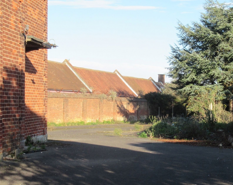
Southern boundary wall to Victualling Yard. Dated 1829, part of the developments under G L Taylor (Evans, p42). Red brick in English bond.
A run of straight wall of approx. 155m length, lying E/W and set approx. 5.2m to the S of and parallel with the outer wall of the S range of cooperage (qv). Wall rises approx. 2.7m, in 1 1/2 brick thickness, increased to 2 brick thickness in a series of broad buttresses on the N side; a brick-on-edge coping crowns the wall, with two courses of a single brick thickness, then a projecting string course capped by a canted tile course.
The wall was provided to enclose a new roadway, beyond the cooperage, for access by cattle being brought to the yard to the new slaughterhouse built at this same date.
(Evans, D: THE ROYAL CLARENCE YARD - Cooperage and Rum Store, Part 1; Hampshire County Council - 2000).
External links are from the relevant listing authority and, where applicable, Wikidata. Wikidata IDs may be related buildings as well as this specific building. If you want to add or update a link, you will need to do so by editing the Wikidata entry.


Other nearby listed buildings
