Approximate Location Map
Large Map »
Latitude: 51.2804 / 51°16'49"N
Longitude: 1.086 / 1°5'9"E
OS Eastings: 615316
OS Northings: 157994
OS Grid: TR153579
Mapcode National: GBR TY2.RCF
Mapcode Global: VHLGM.R2ZS
Plus Code: 9F3373JP+5C
Entry Name: 39 and 40, Broad Street
Listing Date: 7 September 1973
Grade: II
Source: Historic England
Source ID: 1249758
English Heritage Legacy ID: 170416
ID on this website: 101249758
Location: Northgate, Canterbury, Kent, CT1
County: Kent
District: Canterbury
Electoral Ward/Division: Barton
Parish: Non Civil Parish
Built-Up Area: Canterbury
Traditional County: Kent
Lieutenancy Area (Ceremonial County): Kent
Tagged with: Building
1.
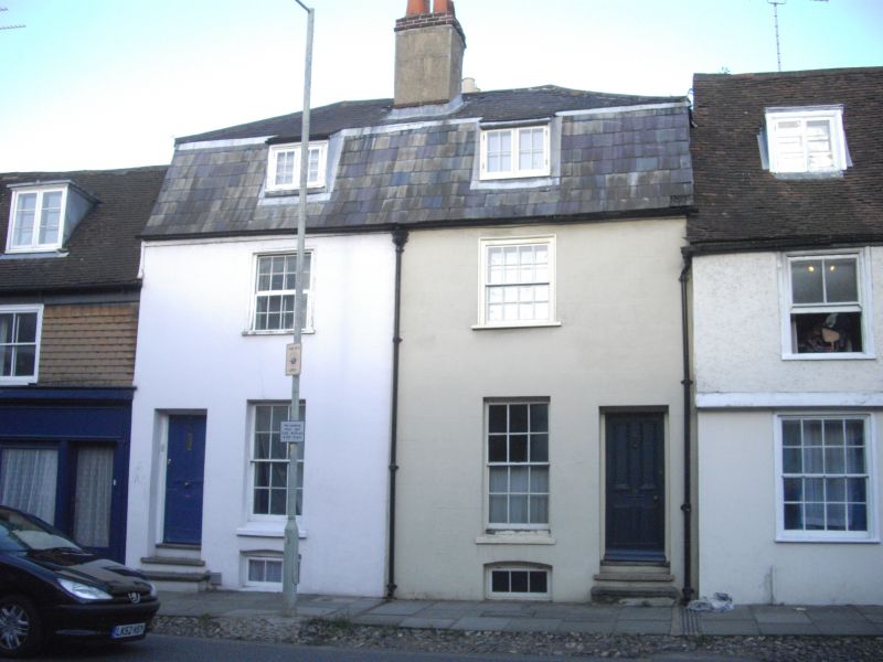
944 BROAD STREET
(North East Side)
Nos 39 and 40
TR 1557 NW 5/429
II Gl7
2.
Early C19. 2 storeys basement and attics stuccoed. Slate mansard roof,
Rainwater head. 2 sashes with glazing bars intact. Casement on first floor
of No 39. Simple doorcases with 4 panelled doom. 2 stone steps.
Nos 33 to 44 (consec) and No 46 form a group.
Listing NGR: TR1532057991
External links are from the relevant listing authority and, where applicable, Wikidata. Wikidata IDs may be related buildings as well as this specific building. If you want to add or update a link, you will need to do so by editing the Wikidata entry.


Other nearby listed buildings
