Approximate Location Map
Large Map »
Latitude: 51.1509 / 51°9'3"N
Longitude: 0.369 / 0°22'8"E
OS Eastings: 565783
OS Northings: 141742
OS Grid: TQ657417
Mapcode National: GBR NR1.Q4C
Mapcode Global: VHJMX.BBYK
Plus Code: 9F325929+9J
Entry Name: The White House
Listing Date: 20 October 1954
Last Amended: 7 January 1991
Grade: II
Source: Historic England
Source ID: 1250199
English Heritage Legacy ID: 432470
ID on this website: 101250199
Location: Matfield, Tunbridge Wells, Kent, TN12
County: Kent
District: Tunbridge Wells
Civil Parish: Brenchley
Built-Up Area: Brenchley
Traditional County: Kent
Lieutenancy Area (Ceremonial County): Kent
Church of England Parish: Matfield St Luke
Church of England Diocese: Rochester
Tagged with: House
In the entries for the following serial numbers ---
14/156, 14/157, 14/158, 14/159, 14/160, 14/161, 14/162, 14/163, 14/164, 14/165
14/166, 14/167, 14/168, 14/169, 14/170, 14/171, 14/172, 14/173, 14/174, 14/175
14/176, 14/177, 14/178, 14/179, in the parish of Brenchley.
The address shall be amended to read---
"THE GREEN,Matfield" in place of "MATFIELD GREEN"
------------------------------------
TQ 65 41 BRENCHLEY MATFIELD GREEN
(south side)
14/159 The White House
20.10.54
GV II
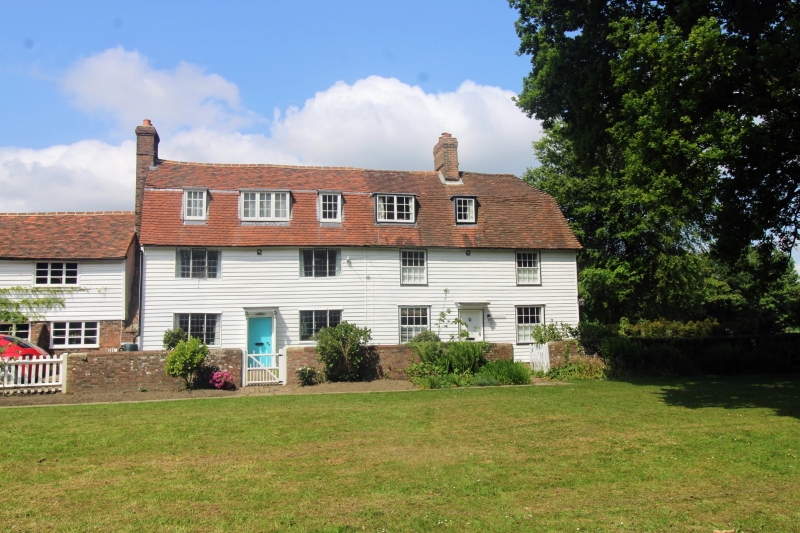
House. Probably early C18. Weatherboarded; peg-tile roof; brick stack.
Plan: Formerly 2 cottages. L-plan, one block facing north across Matfield
Green is 2 rooms wide with a central entrance and a rear. (south) outshut. The
east wing, at right angles adjoins the Forge (q.v.) at the south end. This
also has a central entrance.
Exterior: 2 storeys and attic. Symmetrical 3-bay north and east elevations,
both with moulded eaves cornices. The north front has a half-glazed C19 front
door with a flat porch hood. 3 first floor and 2 ground floor 16-pane sashes.
Mansard roof with 2 flat-roofed attic dormers with small-pane casements. A
single-storey block adjoins at the right (west) end with a matching 16-pane
sash. The east elevation has similar fenestration with only 2 windows to the
first floor and a disused central panelled door with a flat porch hood. Axial
stack to right of door.
Interior: Not accessible at time of survey.
The brick garden wall to the garden east of the house is included in the
listing.
Listing NGR: TQ6578341742
External links are from the relevant listing authority and, where applicable, Wikidata. Wikidata IDs may be related buildings as well as this specific building. If you want to add or update a link, you will need to do so by editing the Wikidata entry.


Other nearby listed buildings
