Approximate Location Map
Large Map »
Latitude: 50.8126 / 50°48'45"N
Longitude: -0.3648 / 0°21'53"W
OS Eastings: 515301
OS Northings: 102724
OS Grid: TQ153027
Mapcode National: GBR HMH.YCF
Mapcode Global: FRA B63Y.KQ2
Plus Code: 9C2XRJ7P+23
Entry Name: 8, Warwick Place
Listing Date: 21 May 1976
Grade: II
Source: Historic England
Source ID: 1250627
English Heritage Legacy ID: 433067
ID on this website: 101250627
Location: Worthing, West Sussex, BN11
County: West Sussex
District: Worthing
Electoral Ward/Division: Central
Parish: Non Civil Parish
Built-Up Area: Worthing
Traditional County: Sussex
Lieutenancy Area (Ceremonial County): West Sussex
Church of England Parish: Worthing St George
Church of England Diocese: Chichester
Tagged with: Building
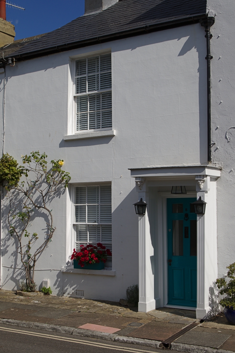
WARWICK PLACE
1.
5406
(East Side)
No 8
TQ 1502 NW 5/143
II GV
2.
Possibly circa 1820. 2 storeys. Stuccoed. Slate roof. One sash window with
glazing bars. Right-hand porch, of rectangular form, with posts in form of bundles
of rods, winged cherubs as corbels and decorated flat hood.
Nos 5 to 8 (consec) form a group.
Listing NGR: TQ1530102724
External links are from the relevant listing authority and, where applicable, Wikidata. Wikidata IDs may be related buildings as well as this specific building. If you want to add or update a link, you will need to do so by editing the Wikidata entry.


Other nearby listed buildings
