Approximate Location Map
Large Map »
Latitude: 51.7469 / 51°44'48"N
Longitude: -0.5145 / 0°30'52"W
OS Eastings: 502651
OS Northings: 206396
OS Grid: TL026063
Mapcode National: GBR G6R.GR9
Mapcode Global: VHFS5.1CC6
Plus Code: 9C3XPFWP+P6
Entry Name: Winkwell
Listing Date: 17 February 1977
Grade: II
Source: Historic England
Source ID: 1251189
English Heritage Legacy ID: 433833
ID on this website: 101251189
Location: Winkwell, Dacorum, Hertfordshire, HP1
County: Hertfordshire
District: Dacorum
Electoral Ward/Division: Bovingdon, Flaunden and Chipperfield
Parish: Non Civil Parish
Built-Up Area: Bourne End
Traditional County: Hertfordshire
Lieutenancy Area (Ceremonial County): Hertfordshire
Church of England Parish: Bourne End St John
Church of England Diocese: St.Albans
Tagged with: Building
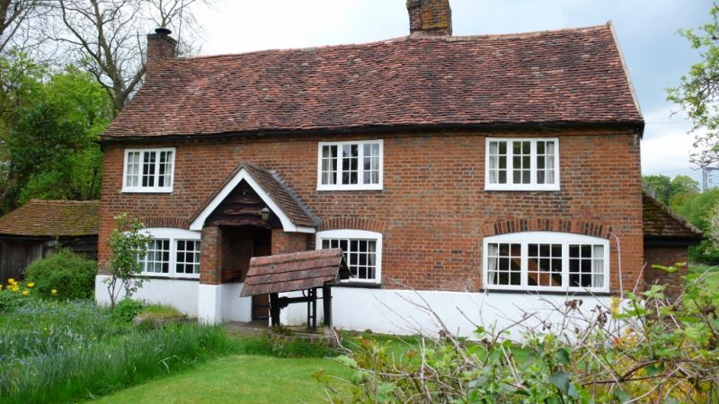
WINKWELL
1.
5252
Bourne End
"Winkwell"
TL 0206 5/241
II
2.
C16 or Cl7, formerly a blacksmith's house. Forge, now demolished, adjoined house
on north side. Timber frame, front wall rebuilt in red brick. 2 storeys, 3
casement windows with glazing bars. Many timbers visible inside.
Listing NGR: TL0271306369
External links are from the relevant listing authority and, where applicable, Wikidata. Wikidata IDs may be related buildings as well as this specific building. If you want to add or update a link, you will need to do so by editing the Wikidata entry.


Other nearby listed buildings
