Approximate Location Map
Large Map »
Latitude: 51.2799 / 51°16'47"N
Longitude: 1.0815 / 1°4'53"E
OS Eastings: 615000
OS Northings: 157927
OS Grid: TR150579
Mapcode National: GBR TY2.Q76
Mapcode Global: VHLGM.P3L5
Plus Code: 9F3373HJ+XH
Entry Name: 9, the Cathedral Precincts
Listing Date: 7 September 1973
Grade: II
Source: Historic England
Source ID: 1252895
English Heritage Legacy ID: 170546
ID on this website: 101252895
Location: Canterbury, Kent, CT1
County: Kent
District: Canterbury
Electoral Ward/Division: Westgate
Parish: Non Civil Parish
Built-Up Area: Canterbury
Traditional County: Kent
Lieutenancy Area (Ceremonial County): Kent
Tagged with: Building
1.
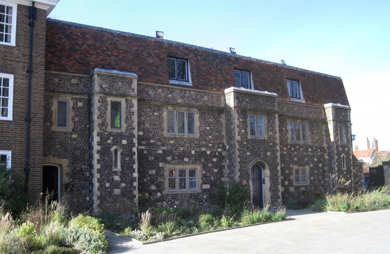
944 THE CATHEDRAL PRECINCTS
No 9
TR 1457 NE 4/459
TR 1557 NW 5/459
II
2.
An early C20 building incorporating earlier masonry. 2 storeys flint with
stone dressings. Some fragments of Mediaeval masonry are incorporated in
the walls, Stone parapet, Metal-framed casements with hoof mouldings over
on ground floor.
Listing NGR: TR1499957926
External links are from the relevant listing authority and, where applicable, Wikidata. Wikidata IDs may be related buildings as well as this specific building. If you want to add or update a link, you will need to do so by editing the Wikidata entry.


Other nearby listed buildings
