Approximate Location Map
Large Map »
Latitude: 51.442 / 51°26'31"N
Longitude: 0.7495 / 0°44'58"E
OS Eastings: 591177
OS Northings: 175026
OS Grid: TQ911750
Mapcode National: GBR RS1.J9M
Mapcode Global: VHKJ6.Y02X
Plus Code: 9F32CPRX+QQ
Entry Name: Red Lion Public House
Listing Date: 30 June 1978
Grade: II
Source: Historic England
Source ID: 1258224
English Heritage Legacy ID: 444607
Also known as: Red Lion
The Red Lion, Sheerness
ID on this website: 101258224
Location: Blue Town, Swale, Kent, ME12
County: Kent
District: Swale
Electoral Ward/Division: Sheerness
Parish: Sheerness
Built-Up Area: Sheerness
Traditional County: Kent
Lieutenancy Area (Ceremonial County): Kent
Tagged with: Pub
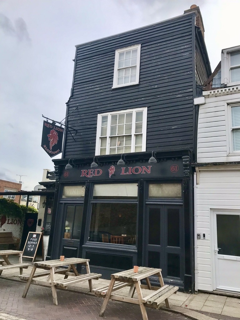
HIGH STREET
1.
5282
(South Side)
Blue Town, Sheerness
Red Lion Public House
TQ 9175 SW 2/21
II GV
2.
C18. 3 storeys weatherboarded. Parapet and hipped tiled roof. Tripartite
window to 1st floor and single sash window above. C19 shopfront.
Listing NGR: TQ9117775026
External links are from the relevant listing authority and, where applicable, Wikidata. Wikidata IDs may be related buildings as well as this specific building. If you want to add or update a link, you will need to do so by editing the Wikidata entry.


Other nearby listed buildings
