Approximate Location Map
Large Map »
Latitude: 51.4391 / 51°26'20"N
Longitude: 0.7626 / 0°45'45"E
OS Eastings: 592100
OS Northings: 174744
OS Grid: TQ921747
Mapcode National: GBR RS2.MMF
Mapcode Global: VHKJ7.53J3
Plus Code: 9F32CQQ7+J2
Entry Name: 97, HIGH STREET (See details for further address information)
Listing Date: 30 June 1978
Grade: II
Source: Historic England
Source ID: 1258227
English Heritage Legacy ID: 444612
ID on this website: 101258227
Location: Sheerness, Swale, Kent, ME12
County: Kent
District: Swale
Electoral Ward/Division: Sheerness
Parish: Sheerness
Built-Up Area: Sheerness
Traditional County: Kent
Lieutenancy Area (Ceremonial County): Kent
Tagged with: Building
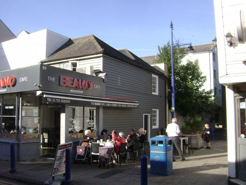
HIGH STREET
1.
5282
(West Side)
Mile Town, Sheerness
No 97
TQ 9274 NW 9/29
II
2.
Late C18 to early C19. Corner building. 2 storeys weatherboarded. Renewed
tiled roof in 2 hips. 1 sash with glazing bars intact to ground floor window
only on Wood Street elevation. Doorcase with wooden cornice and brackets and
4 flush panels.
Listing NGR: TQ9210074744
External links are from the relevant listing authority and, where applicable, Wikidata. Wikidata IDs may be related buildings as well as this specific building. If you want to add or update a link, you will need to do so by editing the Wikidata entry.


Other nearby listed buildings
