Approximate Location Map
Large Map »
Latitude: 51.284 / 51°17'2"N
Longitude: 1.0714 / 1°4'16"E
OS Eastings: 614277
OS Northings: 158357
OS Grid: TR142583
Mapcode National: GBR TY2.FP3
Mapcode Global: VHLGF.JZ7K
Plus Code: 9F3373MC+JG
Entry Name: 3, West Place
Listing Date: 16 August 1989
Grade: II
Source: Historic England
Source ID: 1258440
English Heritage Legacy ID: 444999
ID on this website: 101258440
Location: St Dunstan's, Canterbury, Kent, CT2
County: Kent
District: Canterbury
Electoral Ward/Division: St Stephen's
Parish: Non Civil Parish
Built-Up Area: Canterbury
Traditional County: Kent
Lieutenancy Area (Ceremonial County): Kent
Tagged with: Building
TR 1458 SW CANTERBURY WEST PLACE
1/779
No 3
GV
II
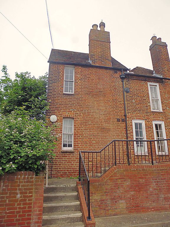
Cottage, derelict at time of survey. c.1820. Front rendered to imitate
stucco; side tarred, rear red brick with old tiled roof. 2 storeys, 1 window.
12-pane sash cambered to ground floor. Right side round-headed doorcase with
blank fanlight and 6 beaded panelled door. Interior has wooden fireplace and 4
panelled door.
Listing NGR: TR1427758357
External links are from the relevant listing authority and, where applicable, Wikidata. Wikidata IDs may be related buildings as well as this specific building. If you want to add or update a link, you will need to do so by editing the Wikidata entry.


Other nearby listed buildings
