Approximate Location Map
Large Map »
Latitude: 51.4404 / 51°26'25"N
Longitude: 0.779 / 0°46'44"E
OS Eastings: 593232
OS Northings: 174932
OS Grid: TQ932749
Mapcode National: GBR RS2.RRB
Mapcode Global: VHKJ7.G253
Plus Code: 9F32CQRH+5H
Entry Name: Stable Block to South West of Number 124
Listing Date: 2 March 1950
Grade: II
Source: Historic England
Source ID: 1258794
English Heritage Legacy ID: 445681
ID on this website: 101258794
Location: Marine Town, Swale, Kent, ME12
County: Kent
District: Swale
Electoral Ward/Division: Sheerness
Parish: Sheerness
Built-Up Area: Sheerness
Traditional County: Kent
Lieutenancy Area (Ceremonial County): Kent
Tagged with: Stable
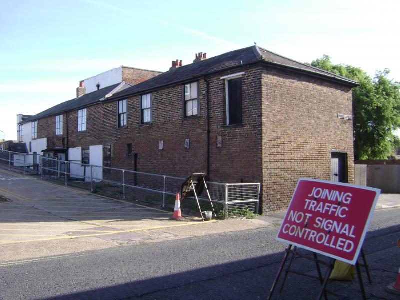
MARINE PARADE
1.
5282
(North Side)
Marine Town, Sheerness
Stable block to
south-west of No 124
TQ 97 SW 11/78 2.3.50.
II GV
2.
Mid C19. 2 storeys buff brick with hipped slate roof. 7 sashes, mostly with
verticals only. 1 square 4-light bay on the ground floor and hipped slate
weatherporch.
Listing NGR: TQ9323274932
External links are from the relevant listing authority and, where applicable, Wikidata. Wikidata IDs may be related buildings as well as this specific building. If you want to add or update a link, you will need to do so by editing the Wikidata entry.


Other nearby listed buildings
