Approximate Location Map
Large Map »
Latitude: 51.2748 / 51°16'29"N
Longitude: 1.0739 / 1°4'26"E
OS Eastings: 614497
OS Northings: 157341
OS Grid: TR144573
Mapcode National: GBR TY8.29Y
Mapcode Global: VHLGM.K7L1
Plus Code: 9F3373FF+WH
Entry Name: 10 and 12, Wincheap
Listing Date: 7 September 1973
Grade: II
Source: Historic England
Source ID: 1259803
English Heritage Legacy ID: 444111
ID on this website: 101259803
Location: Canterbury, Kent, CT1
County: Kent
District: Canterbury
Electoral Ward/Division: Westgate
Parish: Non Civil Parish
Built-Up Area: Canterbury
Traditional County: Kent
Lieutenancy Area (Ceremonial County): Kent
Tagged with: Building
1.
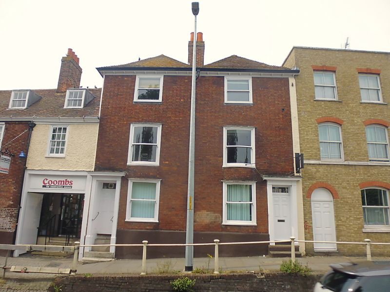
944 WINCHEAP
(North West Side)
Nos 10 and 12
TR 1457 SW 7/356
II
2.
Formerly shown as Nos 4 and 5.
Early C19 fronts to probably older buildings. 3 storeys red brick. 2 hipped
tiled roofs, Bracket eaves cornice. Cambered sashes without glazing bars.
Early C19 doorcases with vestigial hoods and pilasters. Steps to street.
Listing NGR: TR1449157336
External links are from the relevant listing authority and, where applicable, Wikidata. Wikidata IDs may be related buildings as well as this specific building. If you want to add or update a link, you will need to do so by editing the Wikidata entry.


Other nearby listed buildings
