Approximate Location Map
Large Map »
Latitude: 51.2797 / 51°16'46"N
Longitude: 1.0807 / 1°4'50"E
OS Eastings: 614948
OS Northings: 157905
OS Grid: TR149579
Mapcode National: GBR TY2.Q1S
Mapcode Global: VHLGM.P359
Plus Code: 9F3373HJ+V7
Entry Name: 3 and 4, Sun Street
Listing Date: 7 September 1973
Grade: II
Source: Historic England
Source ID: 1259877
English Heritage Legacy ID: 443452
ID on this website: 101259877
Location: Canterbury, Kent, CT1
County: Kent
District: Canterbury
Electoral Ward/Division: Westgate
Parish: Non Civil Parish
Built-Up Area: Canterbury
Traditional County: Kent
Lieutenancy Area (Ceremonial County): Kent
Tagged with: Building
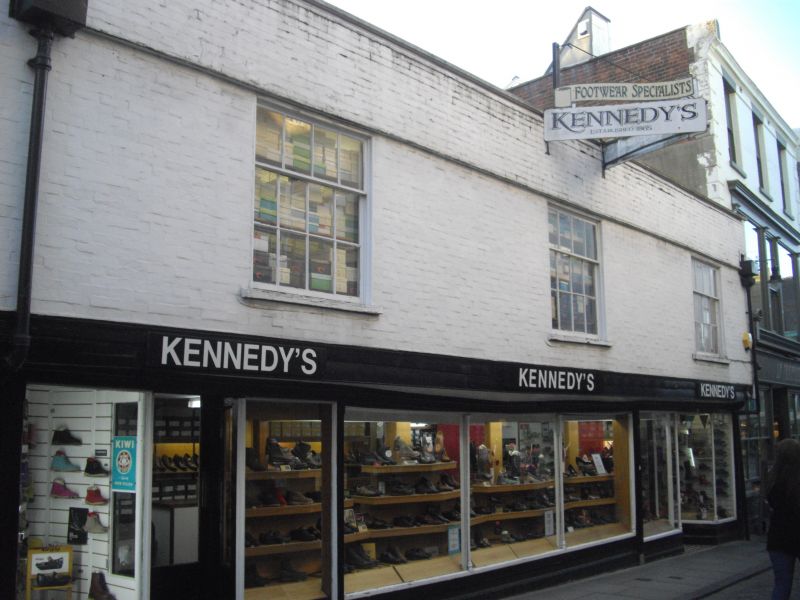
1.
944 SUN STREET
(West Side)
Nos 3 and 4
TR 1457 NE 4/271
II GV
2.
C18 exterior to Mediaeval building. 2 storeys painted brick, 3 sashes set
in moulded architrave with glazing bars intact. Overhang. Late C19 shop
front.
Nos 1 to 9 (consec) form a group.
Listing NGR: TR1494257906
External links are from the relevant listing authority and, where applicable, Wikidata. Wikidata IDs may be related buildings as well as this specific building. If you want to add or update a link, you will need to do so by editing the Wikidata entry.


Other nearby listed buildings
