Approximate Location Map
Large Map »
Latitude: 51.2782 / 51°16'41"N
Longitude: 1.0769 / 1°4'36"E
OS Eastings: 614692
OS Northings: 157721
OS Grid: TR146577
Mapcode National: GBR TY2.WL6
Mapcode Global: VHLGM.M45H
Plus Code: 9F3373HG+7Q
Entry Name: 26, Stour Street
Listing Date: 7 September 1973
Grade: II
Source: Historic England
Source ID: 1259907
English Heritage Legacy ID: 443437
ID on this website: 101259907
Location: Canterbury, Kent, CT1
County: Kent
District: Canterbury
Electoral Ward/Division: Westgate
Parish: Non Civil Parish
Built-Up Area: Canterbury
Traditional County: Kent
Lieutenancy Area (Ceremonial County): Kent
Tagged with: Building
1.
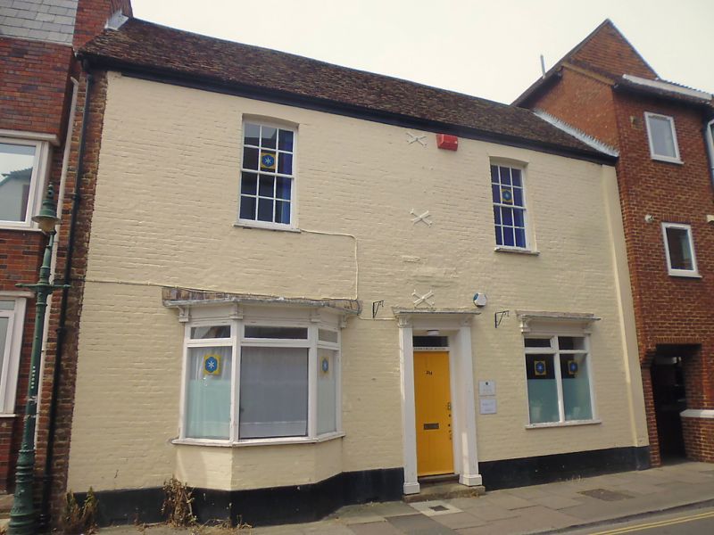
944 STOUR STREET
(North West Side)
No 26
TR 1457 NE 4/182A
II
2.
Late C18 or early C19. 2 storeys painted brick, Old tiled roof, 2 cambered
sashes. Rainwater head. Ground floor altered. 1 C19 3 light canted bay.
Simple doorcase with wooden architrave and fanlight.
Listing NGR: TR1469157723
External links are from the relevant listing authority and, where applicable, Wikidata. Wikidata IDs may be related buildings as well as this specific building. If you want to add or update a link, you will need to do so by editing the Wikidata entry.


Other nearby listed buildings
