Approximate Location Map
Large Map »
Latitude: 51.2776 / 51°16'39"N
Longitude: 1.0763 / 1°4'34"E
OS Eastings: 614654
OS Northings: 157654
OS Grid: TR146576
Mapcode National: GBR TY2.WF8
Mapcode Global: VHLGM.L4WY
Plus Code: 9F3373HG+2G
Entry Name: 63 and 64, Stour Street
Listing Date: 7 September 1973
Grade: II
Source: Historic England
Source ID: 1259908
English Heritage Legacy ID: 443442
ID on this website: 101259908
Location: Canterbury, Kent, CT1
County: Kent
District: Canterbury
Electoral Ward/Division: Westgate
Parish: Non Civil Parish
Built-Up Area: Canterbury
Traditional County: Kent
Lieutenancy Area (Ceremonial County): Kent
Tagged with: Building
1.
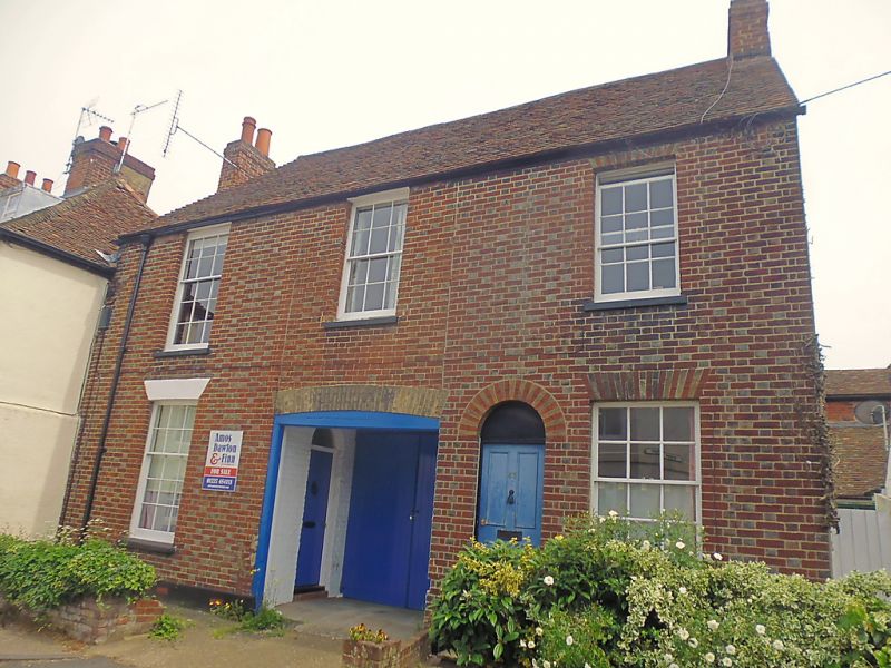
944 STOUR STREET
(South East Side)
Nos 63 and 64
TR 1457 NE 4/711
II GV
2.
Early C19. 2 storeys red brick with grey headers, Hipped tiled roof. 3
sashes. 1 with vertical glazing bars only. No 63 has a simple round-headed
doorcase, No 64 has a door set in a cambered arch.
Nos 63 to 68A form a group.
Listing NGR: TR1465557650
External links are from the relevant listing authority and, where applicable, Wikidata. Wikidata IDs may be related buildings as well as this specific building. If you want to add or update a link, you will need to do so by editing the Wikidata entry.


Other nearby listed buildings
