Approximate Location Map
Large Map »
Latitude: 51.2811 / 51°16'51"N
Longitude: 1.0768 / 1°4'36"E
OS Eastings: 614671
OS Northings: 158046
OS Grid: TR146580
Mapcode National: GBR TY2.P19
Mapcode Global: VHLGM.M247
Plus Code: 9F3373JG+CP
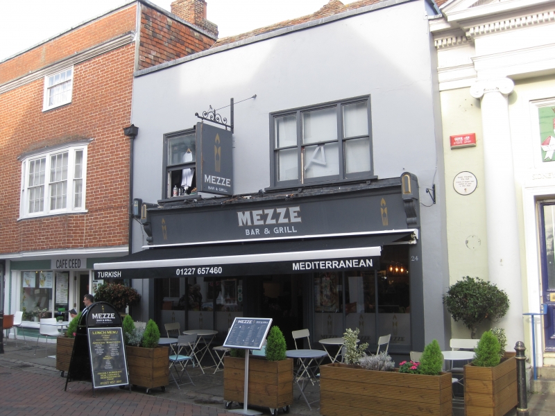
Entry Name: 24, St Peter's Street
Listing Date: 7 September 1973
Grade: II
Source: Historic England
Source ID: 1260018
English Heritage Legacy ID: 441715
ID on this website: 101260018
Location: Canterbury, Kent, CT1
County: Kent
District: Canterbury
Electoral Ward/Division: Westgate
Parish: Non Civil Parish
Built-Up Area: Canterbury
Traditional County: Kent
Lieutenancy Area (Ceremonial County): Kent
Tagged with: Building
1.
944 ST PETER'S STREET
(North East Side)
No 24
TR 1458 SE 2/684
II GV
2.
Early C19 facade to earlier timber framed building. 2 storeys rendered.
Old tiled roof. 2 sashes with one triple sash on the 1st floor. Later shop
front. Grade II for group value.
Nos 19 to 27A (consec) form a group.
Listing NGR: TR1467158046
External links are from the relevant listing authority and, where applicable, Wikidata. Wikidata IDs may be related buildings as well as this specific building. If you want to add or update a link, you will need to do so by editing the Wikidata entry.


Other nearby listed buildings
