Approximate Location Map
Large Map »
Latitude: 51.2777 / 51°16'39"N
Longitude: 1.0793 / 1°4'45"E
OS Eastings: 614860
OS Northings: 157682
OS Grid: TR148576
Mapcode National: GBR TY2.X9B
Mapcode Global: VHLGM.N4FT
Plus Code: 9F3373HH+3P
Entry Name: 8, St Margaret's Street
Listing Date: 3 December 1949
Grade: II
Source: Historic England
Source ID: 1260184
English Heritage Legacy ID: 441196
ID on this website: 101260184
Location: Canterbury, Kent, CT1
County: Kent
District: Canterbury
Electoral Ward/Division: Westgate
Parish: Non Civil Parish
Built-Up Area: Canterbury
Traditional County: Kent
Lieutenancy Area (Ceremonial County): Kent
Tagged with: Building
1.
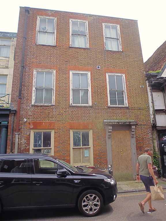
944 ST MARGARET'S STREET
(South East Side)
No 8
TR 1457 NE 4/194 3.12.49
II GV
2.
Rebuilt in facsimile after war damage. Only the ground floor is original.
3 storeys red brick. Stone coping. 3 sashes with verticals only. Original
early C19 doorcase has semi-hood and scrolled brackets and interesting floral
decorated frieze.
Nos 5 to 8 (consec) form a group.
Listing NGR: TR1486057682
External links are from the relevant listing authority and, where applicable, Wikidata. Wikidata IDs may be related buildings as well as this specific building. If you want to add or update a link, you will need to do so by editing the Wikidata entry.


Other nearby listed buildings
