Approximate Location Map
Large Map »
Latitude: 51.2816 / 51°16'53"N
Longitude: 1.0753 / 1°4'31"E
OS Eastings: 614565
OS Northings: 158100
OS Grid: TR145581
Mapcode National: GBR TY2.NNV
Mapcode Global: VHLGM.L1BV
Plus Code: 9F3373JG+J4
Entry Name: 95, St Dunstan's Street
Listing Date: 7 September 1973
Grade: II
Source: Historic England
Source ID: 1260255
English Heritage Legacy ID: 441182
ID on this website: 101260255
Location: Canterbury, Kent, CT2
County: Kent
District: Canterbury
Electoral Ward/Division: Westgate
Parish: Non Civil Parish
Built-Up Area: Canterbury
Traditional County: Kent
Lieutenancy Area (Ceremonial County): Kent
Tagged with: Building
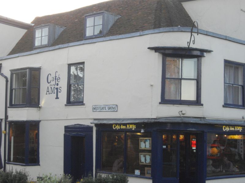
1.
944 ST DUNSTAN'S STREET
(South West Side)
No 95
TR 1458 SE 2/326
II GV
2.
C18 front to possibly older building. 2 storeys plastered. Hipped old tiled
roof. Parapet with coping. Rounded corner. 2 sashes on front elevation,
one on side. Early C19 shopfront with pilasters.
Nos 87 to 95 (consec), Garden Wall & gate piers to No 87 form a group.
Listing NGR: TR1455858097
External links are from the relevant listing authority and, where applicable, Wikidata. Wikidata IDs may be related buildings as well as this specific building. If you want to add or update a link, you will need to do so by editing the Wikidata entry.


Other nearby listed buildings
