Approximate Location Map
Large Map »
Latitude: 51.2786 / 51°16'42"N
Longitude: 1.081 / 1°4'51"E
OS Eastings: 614977
OS Northings: 157779
OS Grid: TR149577
Mapcode National: GBR TY2.XSJ
Mapcode Global: VHLGM.P4C5
Plus Code: 9F3373HJ+CC
Entry Name: 3, the Parade
Listing Date: 7 September 1973
Grade: II
Source: Historic England
Source ID: 1260401
English Heritage Legacy ID: 440584
ID on this website: 101260401
Location: Canterbury, Kent, CT1
County: Kent
District: Canterbury
Electoral Ward/Division: Westgate
Parish: Non Civil Parish
Built-Up Area: Canterbury
Traditional County: Kent
Lieutenancy Area (Ceremonial County): Kent
Tagged with: Building
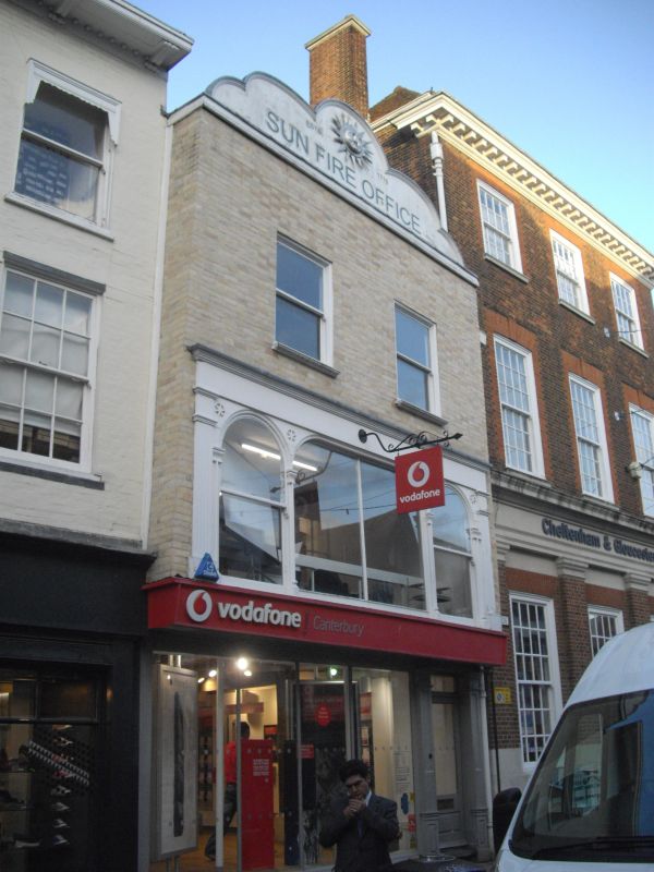
1.
944 THE PARADE
(North East Side)
No 3
TR 1457 NE 4/311
II GV
2.
Timber-framed building, refaced. 3 storeys painted brick. Wooden curved
gable with Sun Fire Office plaque. 2 C19 sashes on 2nd floor. lst floor
has unusual continuous window, with 2 reeded pilasters at end. Ground floor
has C19 shopfront.
Nos 3 & 4 form a group.
Listing NGR: TR1498157783
External links are from the relevant listing authority and, where applicable, Wikidata. Wikidata IDs may be related buildings as well as this specific building. If you want to add or update a link, you will need to do so by editing the Wikidata entry.


Other nearby listed buildings
