Approximate Location Map
Large Map »
Latitude: 51.2786 / 51°16'42"N
Longitude: 1.0805 / 1°4'49"E
OS Eastings: 614942
OS Northings: 157778
OS Grid: TR149577
Mapcode National: GBR TY2.XNN
Mapcode Global: VHLGM.P435
Plus Code: 9F3373HJ+C6
Entry Name: 8, the Parade
Listing Date: 3 May 1967
Grade: II
Source: Historic England
Source ID: 1260483
English Heritage Legacy ID: 440587
ID on this website: 101260483
Location: Canterbury, Kent, CT1
County: Kent
District: Canterbury
Electoral Ward/Division: Westgate
Parish: Non Civil Parish
Built-Up Area: Canterbury
Traditional County: Kent
Lieutenancy Area (Ceremonial County): Kent
Tagged with: Building
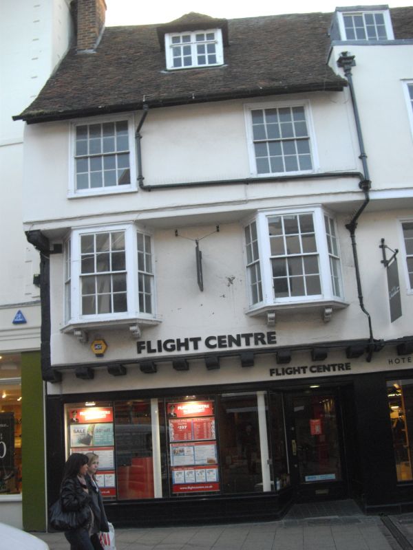
1.
944 THE PARADE
(South West Side)
No 8
TR 1457 NE 4/61 3.5.67.
GV
2.
C16 to C17 timber-framed building plastered over. 3 storeys and dormer.
Old tiled roof with 1 hipped dormer. 2 C18 sashes with glazing bars intact
on 2nd floor. 1st floor has 2 3-light canted bays supported on carved brackets.
Overhang. Modern shopfront.
Nos 8 to 10 (consec) form a group.
Also form a group with Nos 25, 25A & No 26 St Margaret's Street.
Listing NGR: TR1494457772
External links are from the relevant listing authority and, where applicable, Wikidata. Wikidata IDs may be related buildings as well as this specific building. If you want to add or update a link, you will need to do so by editing the Wikidata entry.


Other nearby listed buildings
