Approximate Location Map
Large Map »
Latitude: 51.2811 / 51°16'51"N
Longitude: 1.0814 / 1°4'52"E
OS Eastings: 614989
OS Northings: 158058
OS Grid: TR149580
Mapcode National: GBR TY2.Q6S
Mapcode Global: VHLGM.P2J8
Plus Code: 9F3373JJ+CG
Entry Name: 16, Palace Street
Listing Date: 7 September 1973
Grade: II
Source: Historic England
Source ID: 1260508
English Heritage Legacy ID: 440501
ID on this website: 101260508
Location: Canterbury, Kent, CT1
County: Kent
District: Canterbury
Electoral Ward/Division: Westgate
Parish: Non Civil Parish
Built-Up Area: Canterbury
Traditional County: Kent
Lieutenancy Area (Ceremonial County): Kent
Tagged with: Building
1.
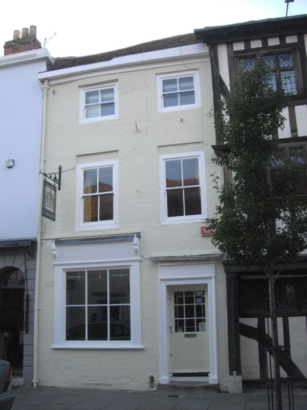
944 PALACE STREET
(West Side)
No 16
TR 1458 SE 2/281
II GV
2.
C18. 3 storeys painted brick. Old tiled roof. 2 altered sashes. Ground
floor early C19 shop front and a right side recessed doorcase with moulded
architrave.
Church of St Alphege and Nos 10 to 28 (consec) form a group.
Listing NGR: TR1498858059
External links are from the relevant listing authority and, where applicable, Wikidata. Wikidata IDs may be related buildings as well as this specific building. If you want to add or update a link, you will need to do so by editing the Wikidata entry.


Other nearby listed buildings
