Approximate Location Map
Large Map »
Latitude: 51.2827 / 51°16'57"N
Longitude: 1.0767 / 1°4'36"E
OS Eastings: 614657
OS Northings: 158224
OS Grid: TR146582
Mapcode National: GBR TY2.H1V
Mapcode Global: VHLGM.M120
Plus Code: 9F3373MG+3M
Entry Name: 20, North Lane
Listing Date: 7 September 1973
Grade: II
Source: Historic England
Source ID: 1260682
English Heritage Legacy ID: 440064
ID on this website: 101260682
Location: Canterbury, Kent, CT2
County: Kent
District: Canterbury
Electoral Ward/Division: Westgate
Parish: Non Civil Parish
Built-Up Area: Canterbury
Traditional County: Kent
Lieutenancy Area (Ceremonial County): Kent
Tagged with: Building
1.
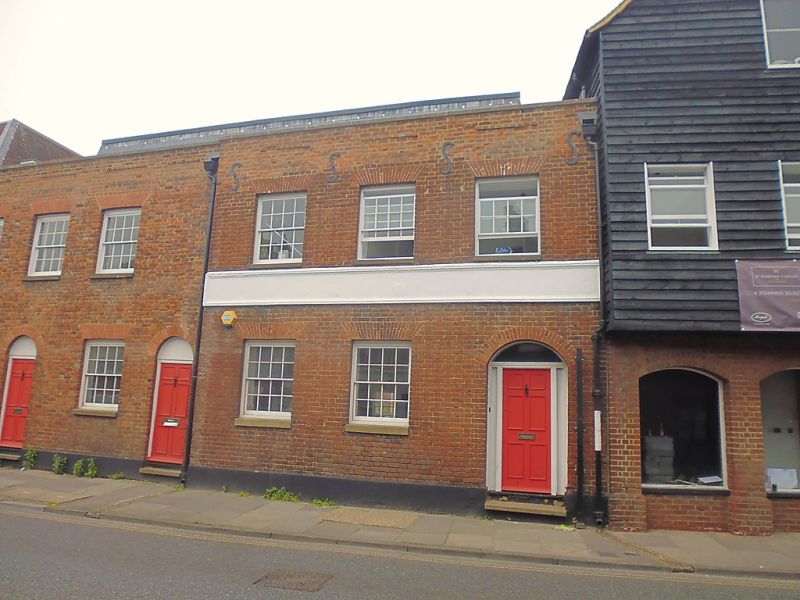
944 NORTH LANE
(North West Side)
No 20
TR 1458 SE 2/581
II
2.
Early C19 facade. 2 storeys red brick. Stone coping, 3 recessed panels
above 1st floor. 2 sashes with glazing bars intact and 1 blank. Plinth.
1 right side round-headed doorcase. Altered windows on the ground floor.
Listing NGR: TR1465758224
External links are from the relevant listing authority and, where applicable, Wikidata. Wikidata IDs may be related buildings as well as this specific building. If you want to add or update a link, you will need to do so by editing the Wikidata entry.


Other nearby listed buildings
