Approximate Location Map
Large Map »
Latitude: 51.2831 / 51°16'58"N
Longitude: 1.0772 / 1°4'38"E
OS Eastings: 614692
OS Northings: 158266
OS Grid: TR146582
Mapcode National: GBR TY2.H63
Mapcode Global: VHLGM.M0CQ
Plus Code: 9F3373MG+6V
Entry Name: 26, North Lane
Listing Date: 3 May 1967
Grade: II
Source: Historic England
Source ID: 1260683
English Heritage Legacy ID: 440067
ID on this website: 101260683
Location: Canterbury, Kent, CT2
County: Kent
District: Canterbury
Electoral Ward/Division: Westgate
Parish: Non Civil Parish
Built-Up Area: Canterbury
Traditional County: Kent
Lieutenancy Area (Ceremonial County): Kent
Tagged with: Building
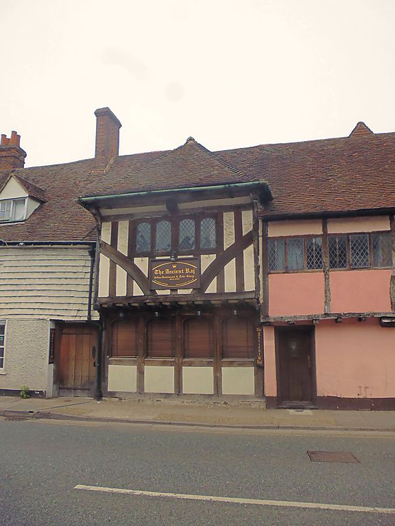
1.
944 NORTH LANE
(North West Side)
No 26
TR 1458 SE 2/128 3.5.67.
II GV
2.
Part of a C15 timber framed range with Nos 25 and 27. Now a garage. Gateway
with a projecting hipped tiled roof on brackets over it, like a hood.
Nos 25 to 27 (consec) form a group.
Listing NGR: TR1469258266
External links are from the relevant listing authority and, where applicable, Wikidata. Wikidata IDs may be related buildings as well as this specific building. If you want to add or update a link, you will need to do so by editing the Wikidata entry.


Other nearby listed buildings
