Approximate Location Map
Large Map »
Latitude: 51.2838 / 51°17'1"N
Longitude: 1.0697 / 1°4'10"E
OS Eastings: 614163
OS Northings: 158324
OS Grid: TR141583
Mapcode National: GBR TY2.F81
Mapcode Global: VHLGF.HZCR
Plus Code: 9F3373M9+GV
Entry Name: 12, London Road
Listing Date: 7 September 1973
Grade: II
Source: Historic England
Source ID: 1260733
English Heritage Legacy ID: 439505
ID on this website: 101260733
Location: St Dunstan's, Canterbury, Kent, CT2
County: Kent
District: Canterbury
Electoral Ward/Division: Westgate
Parish: Non Civil Parish
Built-Up Area: Canterbury
Traditional County: Kent
Lieutenancy Area (Ceremonial County): Kent
Tagged with: Building
1.
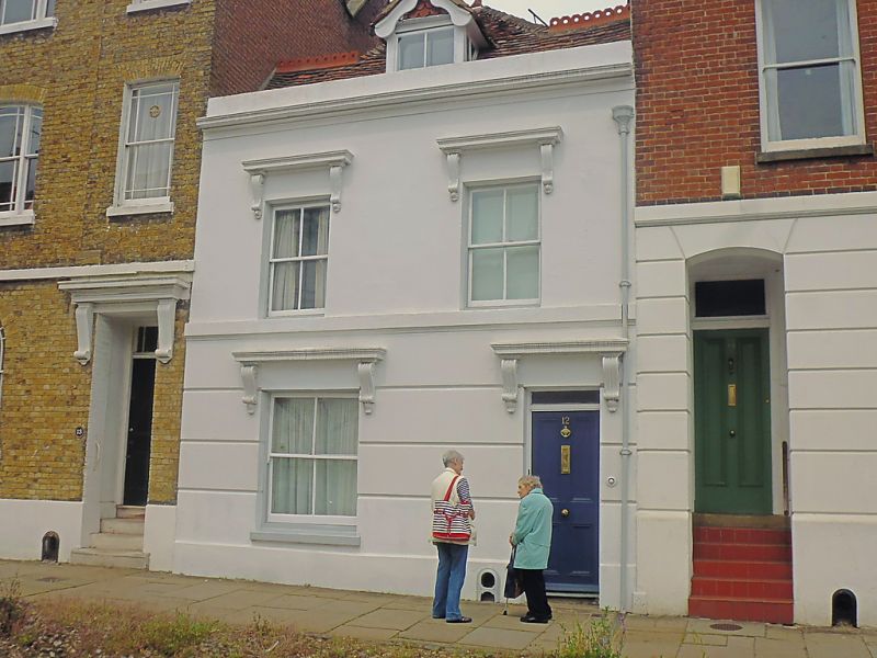
944 LONDON ROAD
(North West Side)
No 12
TR 1458 SW 1/536
II GV
2.
Mid C19. 2 storeys stuccoed. Tiled roof having 1 Victorian hipped dormer.
2 sashes with verticals only, set in Italianate architraves. Plinth, Simple
doorcase.
Nos 1 to 15 (consec) paving and cobbles in front of Nos 1 to 15 (consec)
together with Nos 1 to 3 Whitstable Road form a group.
Listing NGR: TR1416358324
External links are from the relevant listing authority and, where applicable, Wikidata. Wikidata IDs may be related buildings as well as this specific building. If you want to add or update a link, you will need to do so by editing the Wikidata entry.


Other nearby listed buildings
