Approximate Location Map
Large Map »
Latitude: 51.2771 / 51°16'37"N
Longitude: 1.0857 / 1°5'8"E
OS Eastings: 615309
OS Northings: 157628
OS Grid: TR153576
Mapcode National: GBR TY2.Z5P
Mapcode Global: VHLGM.R5T9
Plus Code: 9F3373GP+R7
Entry Name: 13, Ivy Lane
Listing Date: 7 September 1973
Grade: II
Source: Historic England
Source ID: 1260828
English Heritage Legacy ID: 439379
ID on this website: 101260828
Location: Canterbury, Kent, CT1
County: Kent
District: Canterbury
Electoral Ward/Division: Barton
Parish: Non Civil Parish
Built-Up Area: Canterbury
Traditional County: Kent
Lieutenancy Area (Ceremonial County): Kent
Tagged with: Building
1.
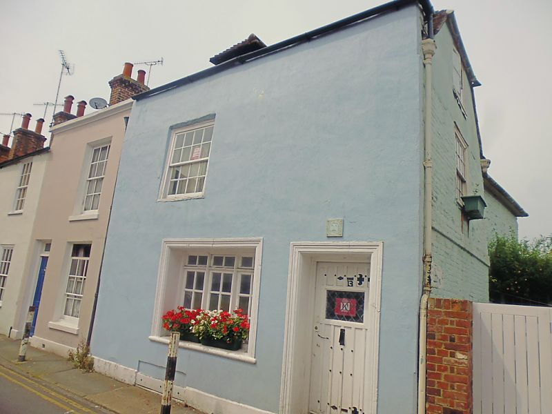
944 IVY LANE
(North Side)
No 13 TR 1557 NW 5/337
II GV
2.
An C18 building refronted. Mid C19 facade. 2 storeys stuccoed. Hipped tiled
roof with parapet. 1 sash with verticals only. Restored doorcase set in
moulded architrave. The side elevation has 1 sash with glazing bars intact
and a stringcourse.
nos 7 to 13 (consec) form a group.
Listing NGR: TR1531257639
External links are from the relevant listing authority and, where applicable, Wikidata. Wikidata IDs may be related buildings as well as this specific building. If you want to add or update a link, you will need to do so by editing the Wikidata entry.


Other nearby listed buildings
