Approximate Location Map
Large Map »
Latitude: 51.443 / 51°26'34"N
Longitude: 0.377 / 0°22'37"E
OS Eastings: 565292
OS Northings: 174239
OS Grid: TQ652742
Mapcode National: GBR NML.D4W
Mapcode Global: VHJLC.HZ5N
Plus Code: 9F32C9VG+6R
Entry Name: New Tavern Fort
Listing Date: 24 February 1977
Grade: II*
Source: Historic England
Source ID: 1261173
English Heritage Legacy ID: 438227
ID on this website: 101261173
Location: Fort Gardens, Milton, Gravesham, Kent, DA12
County: Kent
District: Gravesham
Electoral Ward/Division: Riverside
Parish: Non Civil Parish
Built-Up Area: Gravesend
Traditional County: Kent
Lieutenancy Area (Ceremonial County): Kent
Church of England Parish: Milton St Peter and St Paul
Church of England Diocese: Rochester
Tagged with: Fort Military museum
TQ 6574 SW 2/89
5277
GRAVESEND
New Tavern Fort
II*
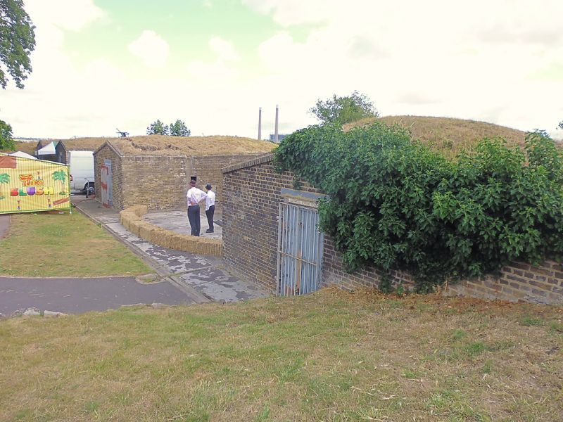
There have been artillery fortifications at Gravesend since the Mid Tudor Period but the earliest development of this site as part of the Thames defences against attack by sea began in 1778, prompted by the threat posed by the American War of Independence. Little trace above ground of these earlier works survives. In 1860 there was a Royal Commission Report on Coastal defences and work began at Gravesend in 1869. From this period are 3 open emplacements for 9 inch rifled nuzzle loading runs along the East face, built of stock brick with cambered brick arches and an unusual form of open emplacements with a heavy wrought-iron casement shield. Connecting with these is an underground brick network of shell and cartridge stores and a main magazine with shell stores. C.1905 2 concrete emplacements for 6 inch breach loading guns were established on part of North side of the fort and 2 bomb-proof shelters were built into the backs of the C19 gun emplacements.
Listing NGR: TQ6529574231
External links are from the relevant listing authority and, where applicable, Wikidata. Wikidata IDs may be related buildings as well as this specific building. If you want to add or update a link, you will need to do so by editing the Wikidata entry.


Other nearby listed buildings
