Approximate Location Map
Large Map »
Latitude: 51.1527 / 51°9'9"N
Longitude: 0.3701 / 0°22'12"E
OS Eastings: 565854
OS Northings: 141938
OS Grid: TQ658419
Mapcode National: GBR NR1.QDJ
Mapcode Global: VHJMX.C9J6
Plus Code: 9F32593C+32
Entry Name: Coach House About 40 Metres North East of Matfield House
Listing Date: 20 October 1954
Last Amended: 7 January 1991
Grade: II*
Source: Historic England
Source ID: 1263150
English Heritage Legacy ID: 433094
ID on this website: 101263150
Location: Matfield, Tunbridge Wells, Kent, TN12
County: Kent
District: Tunbridge Wells
Civil Parish: Brenchley
Built-Up Area: Brenchley
Traditional County: Kent
Lieutenancy Area (Ceremonial County): Kent
Church of England Parish: Matfield St Luke
Church of England Diocese: Rochester
Tagged with: Carriage house
In the entries for the following serial numbers ---
14/156, 14/157, 14/158, 14/159, 14/160, 14/161, 14/162, 14/163, 14/164, 14/165
14/166, 14/167, 14/168, 14/169, 14/170, 14/171, 14/172, 14/173, 14/174, 14/175
14/176, 14/177, 14/178, 14/179, in the parish of Brenchley.
The address shall be amended to read---
"THE GREEN, Matfield" in place of "MATFIELD GREEN"
------------------------------------
TQ 65 41 BRENCHLEY MATFIELD GREEN
(north side)
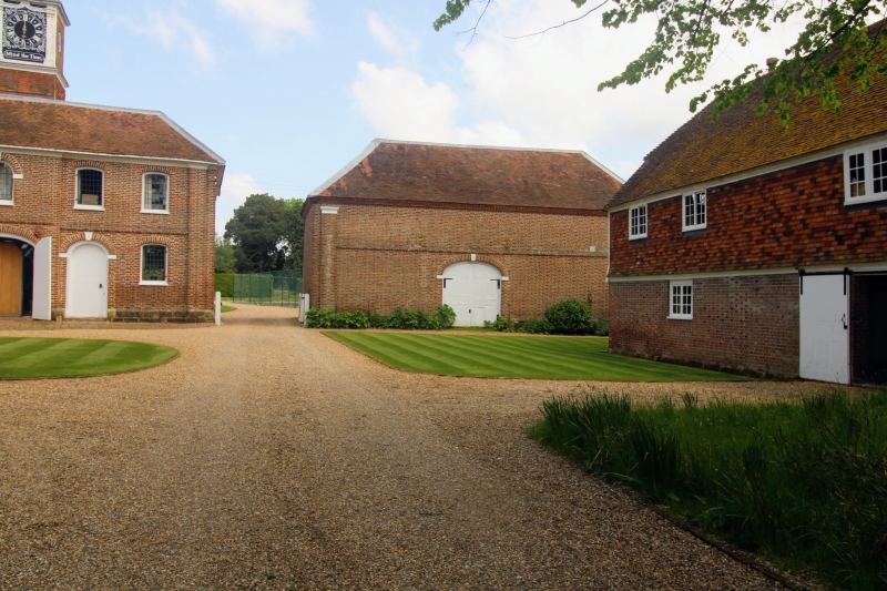
14/172 Coach house about 40m north
east of Matfield House (formerly
20.10.54 included with Matfield House)
GV II*
Coach house. Circa 1736, contemporary with Matfield House and the stable
block. Flemish bond brick to the front elevation, rear elevation
weatherboarded on sandstone footings; peg-tile roof with lead rolls.
Plan: South facing, rectangular on plan with a rear outshut, a large central
doorway on the front and a porch to rear centre. Part of a group of buildings
forming the stable courtyard north east of Matfield House.
Exterior: Single storey. Hipped roof with lead rolls; left and right
pilasters; platband; moulded brick eaves cornice. The front (south) elevation
has a segmental-arched doorway with plain imposts and a keyblock, matching the
doorways on the stable block to the west. 2-leaf C18 door with flush panels
and original HL hinges. The rear elevation has a tall porch with a hipped
roof, flanked by outshuts with catslide roofs. The porch has paired plank
doors; pigeon holes in upper part of porch.
Interior: Not inspected but likely to be of interest.
Listing NGR: TQ6585441938
External links are from the relevant listing authority and, where applicable, Wikidata. Wikidata IDs may be related buildings as well as this specific building. If you want to add or update a link, you will need to do so by editing the Wikidata entry.


Other nearby listed buildings
