Approximate Location Map
Large Map »
Latitude: 52.0554 / 52°3'19"N
Longitude: 1.1586 / 1°9'30"E
OS Eastings: 616648
OS Northings: 244374
OS Grid: TM166443
Mapcode National: GBR TMW.5QJ
Mapcode Global: VHLBT.1LCQ
Plus Code: 9F433545+4C
Entry Name: 4, Orwell Place
Listing Date: 15 December 1977
Grade: II
Source: Historic England
Source ID: 1264397
English Heritage Legacy ID: 427707
ID on this website: 101264397
Location: Ipswich, Suffolk, IP4
County: Suffolk
District: Ipswich
Electoral Ward/Division: Alexandra
Parish: Non Civil Parish
Built-Up Area: Ipswich
Traditional County: Suffolk
Lieutenancy Area (Ceremonial County): Suffolk
Church of England Parish: Ipswich St Clement with St Luke
Church of England Diocese: St.Edmundsbury and Ipswich
Tagged with: Building
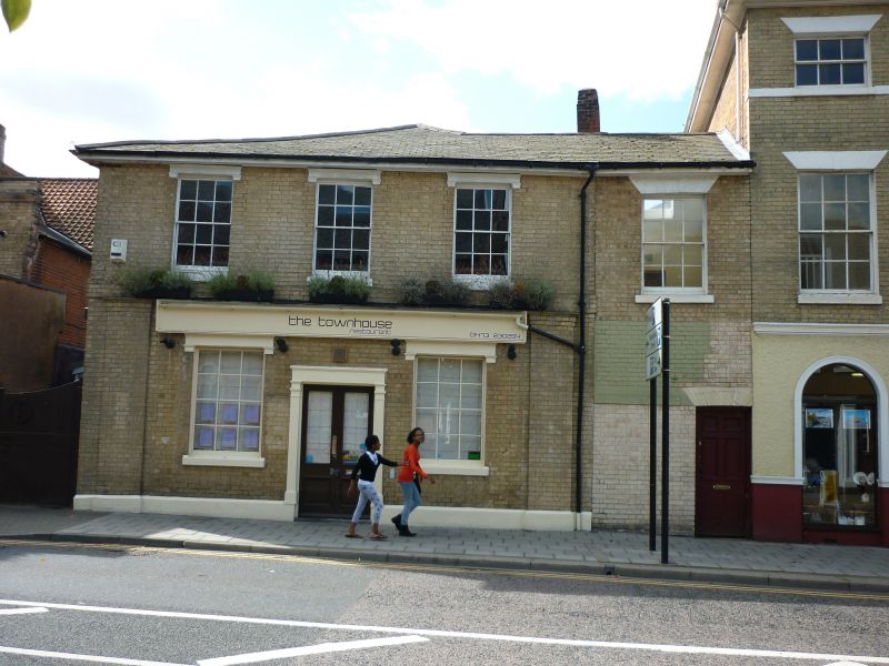
ORWELL PLACE
1.
5379 (South Side)
No 4
TM 1644 SE 4/311
II GV
2.
An early C19 painted brick house. 2 storeys. 3 window range, double-hung sashes
with glazing bars, in plain reveals. The ground storey has 2 small shop windows,
a central doorway and end pilasters. Roof slate.
Listing NGR: TM1664844374
External links are from the relevant listing authority and, where applicable, Wikidata. Wikidata IDs may be related buildings as well as this specific building. If you want to add or update a link, you will need to do so by editing the Wikidata entry.


Other nearby listed buildings
