Approximate Location Map
Large Map »
Latitude: 51.276 / 51°16'33"N
Longitude: 0.5266 / 0°31'35"E
OS Eastings: 576327
OS Northings: 156019
OS Grid: TQ763560
Mapcode National: GBR PR1.V9Y
Mapcode Global: VHJMF.26R4
Plus Code: 9F327GGG+CM
Entry Name: 96 and 98, Union Street
Listing Date: 2 August 1974
Grade: II
Source: Historic England
Source ID: 1266336
English Heritage Legacy ID: 421899
ID on this website: 101266336
Location: Maidstone, Kent, ME14
County: Kent
District: Maidstone
Electoral Ward/Division: High Street
Parish: Non Civil Parish
Built-Up Area: Maidstone
Traditional County: Kent
Lieutenancy Area (Ceremonial County): Kent
Tagged with: Building
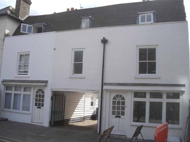
UNION STREET
1.
5278
(South Side)
Not, 96 and 98
TQ 7656 SW 5/363
II GV
2.
C18. 2 storeys stuccoed. Mansard tiled roof with 2 hipped dormers. 3 sashes
with verticals only. Modern shopfront built out in front of no 96 and a C19
shopfront with console brackets to no 98.
Nos 96 to 100 (even), 100A, 102, 106 and 108 together with No 28 Wyatt Street
form a group.
Listing NGR: TQ7632756013
External links are from the relevant listing authority and, where applicable, Wikidata. Wikidata IDs may be related buildings as well as this specific building. If you want to add or update a link, you will need to do so by editing the Wikidata entry.


Other nearby listed buildings
