Approximate Location Map
Large Map »
Latitude: 51.2712 / 51°16'16"N
Longitude: 0.5249 / 0°31'29"E
OS Eastings: 576226
OS Northings: 155483
OS Grid: TQ762554
Mapcode National: GBR PR7.7JP
Mapcode Global: VHJMF.19VT
Plus Code: 9F327GCF+FX
Entry Name: 34, Lower Stone Street
Listing Date: 7 January 1972
Grade: II
Source: Historic England
Source ID: 1266706
English Heritage Legacy ID: 173401
ID on this website: 101266706
Location: Maidstone, Kent, ME15
County: Kent
District: Maidstone
Electoral Ward/Division: High Street
Parish: Non Civil Parish
Built-Up Area: Maidstone
Traditional County: Kent
Lieutenancy Area (Ceremonial County): Kent
Tagged with: Building
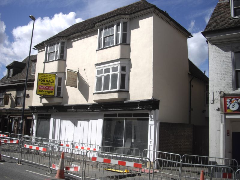
LOWER STONE STREET
1.
5278 (West Side)
No 34
TQ 7655 SW 7/41 7 .1 .72 .
II GV
2.
A timber-framed building refronted in the C18. 3 storeys stuccoed. Tiled
roof with modillion cornice. 2 bays on the 1st and 2nd floors with glazing
bars intact excet in one window. Modern garage front to the ground floor.
Nos 26 to 36 (even), 40 to 46 (even) and 50 to 70 (even) form a group.
Listing NGR: TQ7622655483
External links are from the relevant listing authority and, where applicable, Wikidata. Wikidata IDs may be related buildings as well as this specific building. If you want to add or update a link, you will need to do so by editing the Wikidata entry.


Other nearby listed buildings
