Approximate Location Map
Large Map »
Latitude: 50.6797 / 50°40'46"N
Longitude: -3.463 / 3°27'46"W
OS Eastings: 296731
OS Northings: 87691
OS Grid: SX967876
Mapcode National: GBR P3.3SBN
Mapcode Global: FRA 37M8.YGK
Plus Code: 9C2RMGHP+VQ
Entry Name: 19, the Strand
Listing Date: 18 June 1974
Grade: II
Source: Historic England
Source ID: 1267006
English Heritage Legacy ID: 419899
ID on this website: 101267006
Location: Topsham, Exeter, Devon, EX3
County: Devon
District: Exeter
Electoral Ward/Division: Topsham
Parish: Non Civil Parish
Built-Up Area: Topsham
Traditional County: Devon
Lieutenancy Area (Ceremonial County): Devon
Church of England Parish: Topsham St Margaret
Church of England Diocese: Exeter
Tagged with: Building
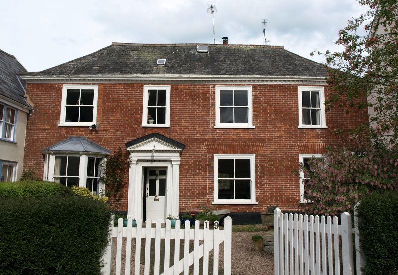
THE STRAND
1.
1092
(East Side)
TOPSHAM
No 19
SX 9688 9/1170
II GV
2.
Early C18 2 storey 4 window red brick front and set back. Poor sash windows, but
good doorcase with fluted pilasters and pediment. One C19 canted bay, otherwise
Cl9 sashes. Hipped slate roof.
All the listed buildings of the Strand form a group.
Listing NGR: SX9673187691
External links are from the relevant listing authority and, where applicable, Wikidata. Wikidata IDs may be related buildings as well as this specific building. If you want to add or update a link, you will need to do so by editing the Wikidata entry.


Other nearby listed buildings
