Approximate Location Map
Large Map »
Latitude: 50.7266 / 50°43'35"N
Longitude: -3.5387 / 3°32'19"W
OS Eastings: 291493
OS Northings: 93018
OS Grid: SX914930
Mapcode National: GBR P0.PPV1
Mapcode Global: FRA 37G5.56C
Plus Code: 9C2RPFG6+JG
Entry Name: 48, St Davids Hill
Listing Date: 18 June 1974
Grade: II
Source: Historic England
Source ID: 1267225
English Heritage Legacy ID: 419314
ID on this website: 101267225
Location: Exeter, Devon, EX4
County: Devon
District: Exeter
Electoral Ward/Division: St David's
Parish: Non Civil Parish
Built-Up Area: Exeter
Traditional County: Devon
Lieutenancy Area (Ceremonial County): Devon
Church of England Parish: Exeter St David
Church of England Diocese: Exeter
Tagged with: Building
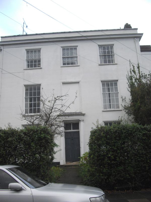
ST DAVID'S HILL
1.
1092
(East Side)
No 48
SX 9193 SE 1/128
SX 9193 11/128
II GV
2.
Late C18/Early C19. Stucco. Three storeys, three windows; the centre ones blind,
the others sashes with glazing bars. Good doorcase, six-panel door with panelled
reveals. Cornice, parapet, roof not visible.
Nos 46 to 54 (even) form a group.
Listing NGR: SX9149393018
External links are from the relevant listing authority and, where applicable, Wikidata. Wikidata IDs may be related buildings as well as this specific building. If you want to add or update a link, you will need to do so by editing the Wikidata entry.


Other nearby listed buildings
